Bucksport in Hancock County, Maine — The American Northeast (New England)
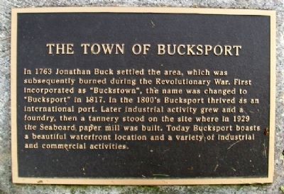
The Town of Bucksport
In 1763 Jonathan Buck settled the area, which was subesequently burned during the Revolutionary War. First incorporated as "Buckstown", the name was changed to "Bucksport" in 1817. In the 1800's Bucksport thrived as an international port. Later industrial activity grew and a foundry, then a tannery stood on the site where in 1929 the Seaboard paper mill was built. Today Bucksport boasts a beautiful waterfront location and a variety of industrial and commercial activities.
Topics. This historical marker is listed in these topic lists: Industry & Commerce • Settlements & Settlers • War, US Revolutionary • Waterways & Vessels. A significant historical year for this entry is 1763.
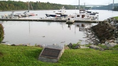
Location. 44° 34.297′ N, 68° 47.731′ W. Marker is in Bucksport, Maine, in Hancock County. Marker is along the Downtown Waterfront Walkway, near the Marina, and about 150 feet SSW of the intersection of Main (Maine Route 15) and Elm Streets. Touch for map. Marker is in this post office area: Bucksport ME 04416, United States of America. Touch for directions.
Other nearby markers. At least 8 other markers are within walking distance of this marker. Fort Knox (within shouting distance of this marker); Penobscot River (within shouting distance of this marker); The Penobscot Expedition (within shouting distance of this marker); The Phineas Heywood House (about 300 feet away, measured in a direct line); Bucksport, Maine (about 400 feet away); Waldo-Hancock Bridge (approx. 0.2 miles away); Rich in Heritage (approx. ¼ mile away); Times of War (approx. ¼ mile away). Touch for a list and map of all markers in Bucksport.
Also see . . . The History of Bucksport. University of Maine PDF (Submitted on May 6, 2012, by William Fischer, Jr. of Scranton, Pennsylvania.)
Credits. This page was last revised on May 31, 2023. It was originally submitted on May 6, 2012, by William Fischer, Jr. of Scranton, Pennsylvania. This page has been viewed 582 times since then and 25 times this year. Photos: 1, 2. submitted on May 6, 2012, by William Fischer, Jr. of Scranton, Pennsylvania.

