Monterey in Monterey County, California — The American West (Pacific Coastal)
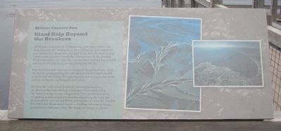
Giant Kelp Beyond the Breakers
Historic Cannery Row
Photographed by Barry Swackhamer, April 23, 2012
1. Giant Kelp Beyond the Breakers Marker
[Photograph captions; left & right] Photograph courtesy of the Monterey Bay Aquarium.
Kelp forests have been important to humans for thousands of years – from the Rumsien people paddling their tule balsas in search of kelp forest fish, to the Spanish and Mexican fur traders hunting otters resting in the canopy, to divers and kayakers exploring this rich habitat.
Monterey Bay is now part of a federally protected marine area – the Monterey Bay National Marine Sanctuary, which stretches from San Francisco to San Simeon. Designated in 1992, the sanctuary is one of the growing number of special underwater areas all over the world that are protected for their rich and diverse communities of marine life. Activities that could harm the sanctuary’s health – oil drilling
this page online
Topics. This historical marker is listed in this topic list: Environment. A significant historical year for this entry is 1992.
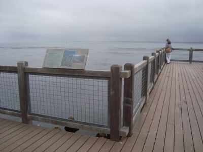
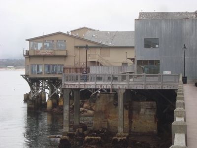
Location. 36° 37.02′ N, 121° 54.014′ W. Marker is in Monterey, California, in Monterey County. It can be reached from Cannery Row. This marker located on the bayfront promenade to the right of the Clement Monterey hotel, 750 Cannery Row. Touch for map. Marker is at or near this postal address: 750 Cannery Row, Monterey CA 93940, United States of America. Touch for directions.

Regionally, this marker is on the Central Coast and specifically on the Coast Ranges. It is also on the American Pacific Coast. Globally, it is in North America, on the Ring of Fire, on the Pacific Rim, in the Western Hemisphere, in the Western World, and in the Anglosphere. Historically, it finds itself in what was once New Spain and also Mexico’s Alta California.
Other nearby markers. At least 8 other markers are within walking distance of this marker: Fish Hoppers (here, next to this marker); Silver Harvest (a few steps from
Photographed by Barry Swackhamer, April 23, 2012
2. Giant Kelp Beyond the Breakers Marker
Photographed by Barry Swackhamer, April 23, 2012
3. The Bayfront Promenade
Credits. This page was last revised on August 9, 2018. It was originally submitted on May 8, 2012, by Barry Swackhamer of Brentwood, California. This page has been viewed 900 times since then and 27 times this year. Photos: 1, 2, 3. submitted on May 8, 2012, by Barry Swackhamer of Brentwood, California. • Bill Pfingsten was the editor who published this page.
