Near Wright in Ford County, Kansas — The American Midwest (Upper Plains)
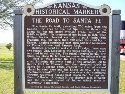
The Road to Santa Fe
Between present Larned and Fort Dodge, there were two routes. One, keeping to the ridges and higher ground, was used in wet weather. The other, favored during dry spells, lay along the bottom lands near the Arkansas river.
West of this marker the trail divided again. One road, following the north bank of the Arkansas, led to Bent's Fort in Colorado and then dropped south to Santa Fe. A second route crossed the river at several palaces between here and the Lakin vicinity. This was the famed cut-off to the Cimarron river which continued through southwest Kansas past Wagon Bed Springs and Point of Rocks. Although it was shorter, lack of water and the constant threat of Indian attack made it extremely dangerous.
Erected by Kansas Historical Society and State Highway Commission. (Marker Number 74.)
Topics and series. This historical marker is listed in this topic list: Roads & Vehicles . In addition, it is included in the Kansas Historical Society, and the Santa Fe Trail series lists. A significant historical year for this entry is 1821.
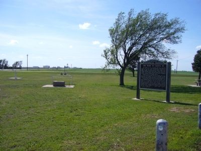
Location. 37° 46.774′ N, 99° 54.29′ W. Marker is near Wright, Kansas, in Ford County. Marker can be reached from the intersection of U.S. 56 and U.S. 283. Marker is in roadside park on northwest corner of crossroads. Touch for map. Marker is in this post office area: Wright KS 67882, United States of America. Touch for directions.
Other nearby markers. At least 8 other markers are within 4 miles of this marker, measured as the crow flies. Cemetery (approx. 3.6 miles away); Fort Dodge (approx. 3.6 miles away); Sutler Store (approx. 3.6 miles away); a different marker also named Fort Dodge (approx. 3.7 miles away); Commanding Officer's Quarters (approx. 3.7 miles away); Wagnor Memorial Fountain (approx. 3.7 miles away); Hospital (approx. 3.7 miles away); Enlisted Men's Barracks (approx. 3.8 miles away).
Credits. This page was last revised on June 16, 2016. It was originally submitted on May 11, 2012, by Bill Kirchner of Tucson, Arizona. This page has been viewed 635 times since then and 21 times this year. Photos: 1, 2. submitted on May 11, 2012, by Bill Kirchner of Tucson, Arizona. • Bill Pfingsten was the editor who published this page.

