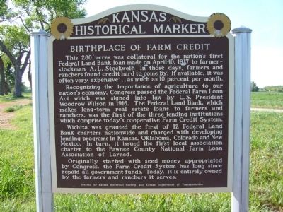
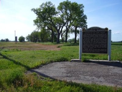
Birthplace of Farm Credit
Recognizing the importance of agriculture to our nation's economy, Congress passed the Federal Farm Loan Act which was signed into law by U.S. President Woodrow Wilson in 1916. The Federal Land Bank, which makes long-term real estate loans to farmers and ranchers, was the first of the three lending institutions which comprise today's cooperative Farm Credit System.
Wichita was granted the first of 12 Federal Land Bank charters nationwide and charged with developing lending programs in Kansas, Oklahoma, Colorado and New Mexico. In turn, it issued the first local association charter to the Pawnee County National Farm Loan Association of Larned.
Originally started with seed money appropriated by Congress, the Farm Credit System has long since repaid all government funds. Today, it is entirely owned by the farmers and ranchers it serves.
Erected by Kansas Historical Society & Kansas Department of Transportation. (Marker Number 108.)
Topics and series. This historical marker is listed in this topic list:
Location. 38° 9.849′ N, 99° 6.97′ W. Marker is near Larned, Kansas, in Pawnee County. Marker is on U.S. 56 at milepost 181, on the left when traveling east. Touch for map. Marker is in this post office area: Larned KS 67550, United States of America. Touch for directions.
Other nearby markers. At least 8 other markers are within 3 miles of this marker, measured as the crow flies. Site of the Larned House (approx. 1.3 miles away); Santa Fe Trail (approx. 1.3 miles away); Veterans Memorial (approx. 1˝ miles away); Site of Original Cash Store (approx. 1.6 miles away); Pawnee County Area All Veterans Memorial (approx. 1.8 miles away); September 11, 2001 (approx. 1.8 miles away); Ak'a Onikashin ga • People of the Southwind (approx. 2.2 miles away); The Mormon Battalion at Larned, Kansas (approx. 2.2 miles away). Touch for a list and map of all markers in Larned.
Credits. This page was last revised on June 16, 2016. It was originally submitted on May 11, 2012, by Bill Kirchner of Tucson, Arizona. This page has been viewed 784 times since then and 59 times this year. Photos: 1, 2. submitted on May 11, 2012, by Bill Kirchner of Tucson, Arizona. • Bill Pfingsten was the editor who published this page.

