Garrison in Putnam County, New York — The American Northeast (Mid-Atlantic)
Twin Redoubts
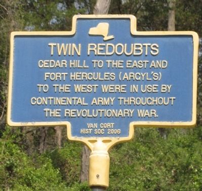
Photographed by Clifton Patrick, April 21, 2012
1. Twin Redoubts Marker
Erected 2006 by Van Courtland Historical Society.
Topics. This historical marker is listed in these topic lists: Patriots & Patriotism • War, US Revolutionary.
Location. 41° 20.79′ N, 73° 54.469′ W. Marker is in Garrison, New York, in Putnam County. It is at the intersection of Old West Point Rd and Old Albany Post Rd, on the left when traveling west on Old West Point Rd. Touch for map. Marker is at or near this postal address: 2 Old West Point Rd E, Garrison NY 10524, United States of America. Touch for directions.

Regionally, this marker is in Upstate New York, specifically in the Hudson Valley, and in the New York City Metropolitan Area. It is also in the American Northeast, in the Mid-Atlantic, and on the Eastern Seaboard. Globally, it is in the North Atlantic Region, North America, the Western Hemisphere, the Western World, and the Anglosphere. Historically, it finds itself in what was once New Netherland and also
this page online
Other nearby markers. At least 8 other markers are within 3 miles of this marker, measured as the crow flies: Old Schoolhouse (approx. 0.4 miles away); Putnam County (approx. 1.6 miles away); Fort Hill (approx. 1.9 miles away); Oregon Corners (approx. 1.9 miles away); Seth Pomeroy & Jeremiah Drake (approx. 2.3 miles away); Saint Peter’s Churchyard & Old Van Cortlandtville Cemetery (approx. 2.3 miles away); Old Cemetery (approx. 2.3 miles away); Heroes of the American Revolution (approx. 2.3 miles away). Touch for a list and map of all markers in Garrison.
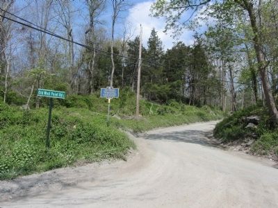
Photographed by Clifton Patrick, April 21, 2012
2. Twin Redoubts Marker at intersection of Old West Point & Old Albany Post Roads.
Credits. This page was last revised on June 16, 2016. It was originally submitted on May 12, 2012, by Clifton Patrick of Chester, NY, United States. This page has been viewed 924 times since then and 55 times this year. Photos: 1, 2. submitted on May 12, 2012, by Clifton Patrick of Chester, NY, United States. • Bill Pfingsten was the editor who published this page.
