Near Solomon in Dickinson County, Kansas — The American Midwest (Upper Plains)
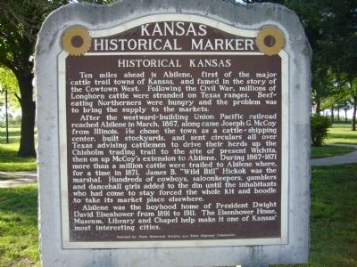
Historical Kansas
Ten miles ahead is Abilene, first of the major cattle trail towns of Kansas, and famed in the story of the Cowtown West. Following the Civil War, millions of Longhorn cattle were stranded on Texas ranges. Beef-eating Northerners were hungry and the problem was to bring the supply to the markets.
After the westward-building Union Pacific railroad reached Abilene in March, 1867, along came Joseph G. McCoy from Illinois. He chose the town as a cattle-shipping center, built stockyards, and sent circulars all over Texas advising cattlemen to drive their herds up the Chisholm trading trail to the site of present Wichita, then on up McCoy's extension to Abilene. During 1867-1871 more than a million cattle were trailed to Abilene where, for a time in 1871, James B. "Wild Bill' Hickok was the marshal. Hundreds of cowboys, saloonkeepers, gamblers and dancehall girls added to the din until the inhabitants who had come to stay forced the whole kit and boodle to take its market place elsewhere.
Abilene was the boyhood home of President Dwight David Eisenhower from 1891 to 1911. The Eisenhower Home, Museum, Library and Chapel help make it one of Kansas' most interesting cities.
Erected by State Historical Society and State Highway Commission.
Topics and series. This historical marker is listed in this topic list: Settlements & Settlers. In addition, it is included in the Former U.S. Presidents: #34 Dwight D. Eisenhower series list. A significant historical month for this entry is March 1867.
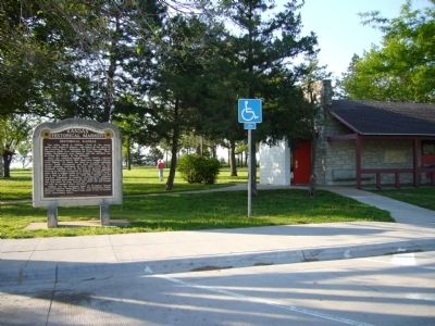
Location. 38° 55.56′ N, 97° 23.664′ W. Marker is near Solomon, Kansas, in Dickinson County. Marker can be reached from Interstate 70 at milepost 265. Marker is in the east bound rest area. Touch for map. Marker is in this post office area: Solomon KS 67480, United States of America. Touch for directions.
Other nearby markers. At least 8 other markers are within 10 miles of this marker, measured as the crow flies. Brewer Scout Cabin (approx. 1.4 miles away); Shady Lane Drive (approx. 1.8 miles away); Harold J. Royer Band Shell (approx. 8.9 miles away); Eisenhower Park (approx. 8.9 miles away); The Grand Army of the Republic (approx. 9 miles away); Site of First Settlers' Home (approx. 9.2 miles away); C. H. Lebold Mansion (approx. 9.2 miles away); J. E. Johntz Home (approx. 9.4 miles away). Touch for a list and map of all markers in Solomon.
Credits. This page was last revised on July 29, 2020. It was originally submitted on May 13, 2012, by Bill Kirchner of Tucson, Arizona. This page has been viewed 1,060 times since then and 81 times this year. Photos: 1, 2. submitted on May 13, 2012, by Bill Kirchner of Tucson, Arizona. • Bill Pfingsten was the editor who published this page.

