Chillicothe
Side A:
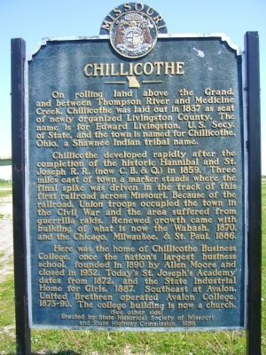
On rolling land above the Grand, and between Thompson River and Medicine Creek, Chillicothe was laid out in 1837 as seat of newly organized Livingston County. The name is for Edward Livingston, U. S. Secy. of State, and the town is named for Chillicothe, Ohio, a Shawnee Indian tribal name.
Chillicothe developed rapidly after the completion of the historic Hannibal and St. Joseph R. R. (now C. B. & Q.) in 1859. Three miles east of town a marker stands where the final spike was driven in the track of this first railroad across Missouri. Because of the railroad, Union troops occupied the town in the Civil War and the area suffered from guerrilla raids. Renewed growth came with building of what is now the Wabash, 1870, and the Chicago, Milwaukee, & St. Paul, 1886.
Here was the home of Chillicothe Business College, once the nation's largest business school, founded in 1890 by Allen Moore and closed in 1952. Today's St. Joseph's Academy dates from 1872, and the State Industrial Home for Girls, 1887. Southeast at Avalon, United Brethren operated Avalon College, 1873-90. The college building is now a church.
Side B:
Chillicothe,
this page online
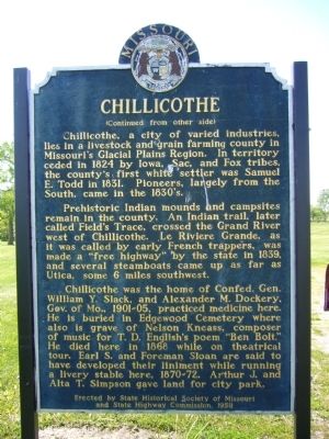
Prehistoric Indian mounds and campsites remain in the county. An Indian trail, later called Field's Trace, crossed the Grand River west of Chillicothe. Le Riviere Grande, as it was called by the early French trappers, was made a "free highway" by the state in 1839, and several steamboats came up as far as Utica, some 6 miles southwest.
Chillicothe was the home of Confed. Gen. William Y. Slack, and Alexander M. Dockery, Gov. of Mo., 1901-05, practiced medicine here. He is buried in Edgewood Cemetery where also is grave of Nelson Kneass, composer of the music for T. D. English's poem "Ben Bolt." He died here in 1868 while on theatrical tour. Earl S. and Foreman Sloan are said to have developed their liniment while running a livery stable here, 1870-72. Arthur J. and Alta T, Simpson gave land for city park.
Erected 1958 by State Historical Society of
Topics and series. This historical marker is listed in this topic list: Settlements & Settlers. In addition, it is included in the Missouri, The State Historical Society of series list. A significant historical year for this entry is 1837.
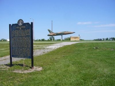
Location. 39° 46.588′ N, 93° 29.725′ W. Marker is in Chillicothe, Missouri, in Livingston County. It is on U.S. 36, on the right when traveling west. Marker is at entrance to airport. Touch for map. Marker is in this post office area: Chillicothe MO 64601, United States of America. Touch for directions.

Regionally, this marker is in the American Midwest, in the Lewis & Clark Corridor, and in the Corn Belt. Globally, it is in North America, the Western Hemisphere, the Western World, and the Anglosphere. Historically, it finds itself in what was once the territory of the Mississippian Culture, the Louisiana Purchase, and the Antebellum South.
Other nearby markers. At least 8 other markers are within 4 miles of this marker, measured as the crow flies: The Home of Sliced Bread (approx. 3.1 miles away); The Frank Bench Bakery (approx. 3.1 miles away); Heroes in History
Credits. This page was last revised on June 16, 2016. It was originally submitted on May 14, 2012, by Bill Kirchner of Tucson, Arizona. This page has been viewed 1,122 times since then and 50 times this year. Photos: 1, 2, 3. submitted on May 14, 2012, by Bill Kirchner of Tucson, Arizona. • Bill Pfingsten was the editor who published this page.
