New Harbor in Lincoln County, Maine — The American Northeast (New England)
Oil House
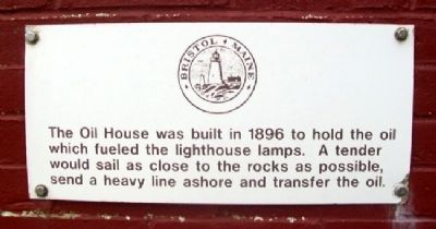
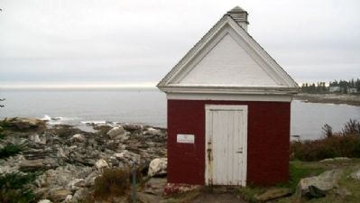
The Oil House was built in 1896 to hold the oil which fueled the lighthouse lamps. A tender would sail as close to the rocks as possible, send a heavy line ashore and transfer the oil.
Topics and series. This historical marker is listed in these topic lists: Communications • Waterways & Vessels. In addition, it is included in the Lighthouses series list. A significant historical year for this entry is 1896.
Location. 43° 50.198′ N, 69° 30.393′ W. Marker is in New Harbor, Maine, in Lincoln County. Marker is at Pemaquid Lighthouse Park, near Pemaquid Point, at the south end of Bristol Road. Touch for map. Marker is in this post office area: New Harbor ME 04554, United States of America. Touch for directions.
Other nearby markers. At least 8 other markers are within 14 miles of this marker, measured as the crow flies. Bell House (within shouting distance of this marker); John Cogswell and Family (within shouting distance of this marker); Pemaquid Point Lighthouse (within shouting distance of this marker); Ralph Blaisdell and Family (within shouting distance of this marker); In Grateful Memory of Ensign Richard Rundlett Wells (approx. 2.4 miles away); Boothbay Maine Civil War Monument (approx. 6.9 miles away); Shipbuilding on the Damariscotta River (approx. 13.6 miles away); R.H.T. Taylor Store in 1882 (approx. 13.9 miles away). Touch for a list and map of all markers in New Harbor.
Also see . . . Pemaquid Point Lighthouse. Lighthouse Friends website entry (Submitted on December 19, 2021, by Larry Gertner of New York, New York.)
Credits. This page was last revised on December 19, 2021. It was originally submitted on May 18, 2012, by William Fischer, Jr. of Scranton, Pennsylvania. This page has been viewed 520 times since then and 19 times this year. Photos: 1, 2. submitted on May 18, 2012, by William Fischer, Jr. of Scranton, Pennsylvania.

