
Bainbridge in Decatur County, Georgia — The American South (South Atlantic)
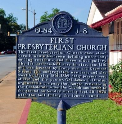
First Presbyterian Church
Photographed by David Seibert, May 17, 2012
1. First Presbyterian Church Marker
Erected by Works Progress Administration. (Marker Number 84 J-8.)
Topics and series. This historical marker is listed in this topic list: Religion & Religious Structures. In addition, it is included in the Georgia Historical Society, and the Works Progress Administration (WPA) projects series lists. A significant historical date for this entry is September 20, 1914.
Location. 30° 54.308′ N, 84° 34.594′ W. Marker is in Bainbridge, Georgia, in Decatur County. It is at the intersection of South West Street and Troupe Street, on the left when traveling north on South West Street. Touch for map. Marker is in this
this page online

Regionally, this marker is in Georgia’s Coastal Plain. It is also in the American South and specifically in the Deep South. Globally, it is in North America, the Western Hemisphere, the Western World, and the Anglosphere. Historically, it finds itself in what was once the territory of the Mississippian Culture, one of the original Thirteen Colonies, one of the Confederate States of America, and the Antebellum South.
Other nearby markers. At least 8 other markers are within walking distance of this marker: In Memory of Revolutionary Soldiers (about 300 feet away, measured in a direct line); Winecoff Memorial (about 400 feet away); Decatur County War Memorial (about 400 feet away); El Camino Real (about 400 feet away); The Bainbridge Volunteers (about 400 feet away); Samuel Marvin Griffin (about 400 feet away); Civil War Cannon (about 500 feet away); De Soto Trail (about 500 feet away). Touch for a list and map of all markers in Bainbridge.
More about this marker. The marker was erected in the late 1930s.
Photographed by David Seibert, May 17, 2012
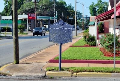
2. First Presbyterian Church Marker
West Street is to the left, and Troupe Street in the foreground. West Shotwell Street (US 84 Business) is in the distance, one block south.
Credits. This page was last revised on June 16, 2016. It was originally submitted on May 19, 2012, by David Seibert of Sandy Springs, Georgia. This page has been viewed 625 times since then and 18 times this year. Photos: 1, 2. submitted on May 19, 2012, by David Seibert of Sandy Springs, Georgia. • Craig Swain was the editor who published this page.
