
South Portland in Cumberland County, Maine — The American Northeast (New England)
Site of Former Schools
Photographed by William Fischer, Jr., September 25, 2011
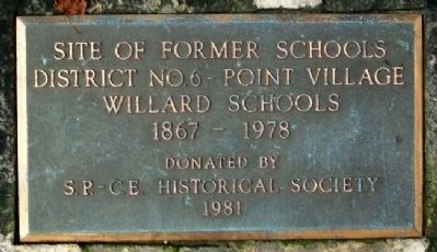
1. Site of Former Schools Marker
District No.6 - Point Village
Willard Schools
1867 - 1978
Erected 1981 by South Portland - Cape Elizabeth Historical Society.
Topics. This historical marker is listed in this topic list: Education. A significant historical year for this entry is 1867.
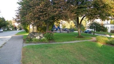
Location. 43° 38.164′ N, 70° 14.058′ W. Marker is in South Portland, Maine, in Cumberland County. It is at the intersection of Pillsbury Street and Chase Street, on the right when traveling north on Pillsbury Street. Marker is in Willard Park. Touch for map. Marker is in this post office area: South Portland ME 04106, United States of America. Touch for directions.

Regionally, this marker is on Southern Maine Coast. It is also in the American Northeast, in New England, and on the Eastern Seaboard. Globally, it is in the North Atlantic Region, North America, the Western Hemisphere, the Western World, and the Anglosphere.
Other nearby markers. At least 8 other markers are within walking distance of this marker: Civil War Memorial (approx. 0.3 miles away); For All Time (approx. 0.6 miles away); Fort Preble (approx. ¾ mile away); Morris
this page online
Photographed by William Fischer, Jr., September 25, 2011
2. Site of Former Schools Marker
Credits. This page was last revised on October 29, 2020. It was originally submitted on May 21, 2012, by William Fischer, Jr. of Reynoldsburg, Ohio. This page has been viewed 747 times since then and 15 times this year. Photos: 1, 2. submitted on May 21, 2012, by William Fischer, Jr. of Reynoldsburg, Ohio.
