South Portland in Cumberland County, Maine — The American Northeast (New England)
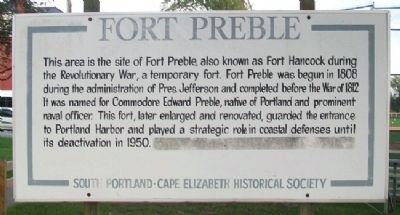
Fort Preble
Erected by South Portland - Cape Elizabeth Historical Society.
Topics. This historical marker is listed in these topic lists: Forts and Castles • War of 1812 • War, US Revolutionary • Waterways & Vessels. A significant historical year for this entry is 1808.
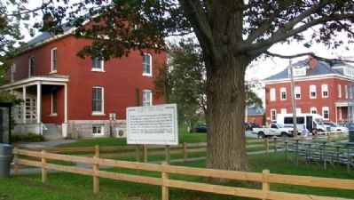
Location. 43° 38.769′ N, 70° 13.797′ W. Marker is in South Portland, Maine, in Cumberland County. Marker is on Fort Road near Campus Center Drive, on the right when traveling north. Marker is south of Cates Hall, on the Southern Maine Community College campus. Touch for map. Marker is at or near this postal address: 88 Fort Road, South Portland ME 04106, United States of America. Touch for directions.
Other nearby markers. At least 8 other markers are within walking distance of this marker. Morris P. Cates (a few steps from this marker); Civilian Conservation Corps (approx. 0.2 miles away); First Congregational Church of South Portland (approx. 0.2 miles away); Coast Artillery Corps at Fort Preble (approx. 0.2 miles away); Coast Artillery Corps Memorial (approx. 0.2 miles away); Early Settlement (approx. ¼ mile away); Shipbuilding (approx. ¼ mile away); West Yard (approx. ¼ mile away). Touch for a list and map of all markers in South Portland.
Also see . . .
1. Fort Preble at Wikipedia. (Submitted on May 21, 2012, by William Fischer, Jr. of Scranton, Pennsylvania.)
2. History of Fort Preble by SMCC. (Submitted on May 21, 2012, by William Fischer, Jr. of Scranton, Pennsylvania.)
Credits. This page was last revised on November 18, 2020. It was originally submitted on May 21, 2012, by William Fischer, Jr. of Scranton, Pennsylvania. This page has been viewed 827 times since then and 52 times this year. Photos: 1, 2. submitted on May 21, 2012, by William Fischer, Jr. of Scranton, Pennsylvania. 3. submitted on November 16, 2020, by Allen C. Browne of Silver Spring, Maryland.


