Bainbridge in Decatur County, Georgia — The American South (South Atlantic)
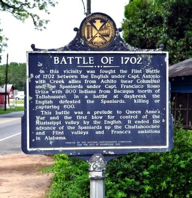
Battle of 1702
This battle was a prelude to Queen Anne’s War and the first blow for control for the Mississippi valley by the English. It ended the advance of the Spaniards up the Chattahoochee and Flint valleys and France’s ambitions in Alabama.
Erected 1985 by Historic Chattahoochee Commission and The City of Bainbridge.
Topics. This historical marker is listed in this topic list: Colonial Era. A significant historical year for this entry is 1702.
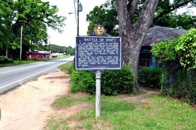
Location. 30° 54.779′ N, 84° 34.001′ W. Marker is in Bainbridge, Georgia, in Decatur County. Marker is on Albany Road (Georgia Route 97) 0 miles north of Carter Street, on the right when traveling north. Touch for map. Marker is in this post office area: Bainbridge GA 39817, United States of America. Touch for directions.
Other nearby markers. At least 8 other markers are within walking distance of this marker. The Tonge Factory (within shouting distance of this marker); a different marker also named Battle of 1702 (about 300 feet away, measured in a direct line); Hutto School (approx. half a mile away); First Flint River Baptist Normal Institute / Union Normal School (approx. 0.6 miles away); Fort Hughes (approx. 0.7 miles away); De Soto Trail (approx. 0.7 miles away); El Camino Real (approx. 0.7 miles away); The Bainbridge Volunteers (approx. ¾ mile away). Touch for a list and map of all markers in Bainbridge.
More about this marker. The text is identical to the nearby Georgia Historical Marker of the same title, erected 32 years earlier.
Credits. This page was last revised on February 22, 2018. It was originally submitted on May 22, 2012, by David Seibert of Sandy Springs, Georgia. This page has been viewed 687 times since then and 20 times this year. Photos: 1, 2. submitted on May 22, 2012, by David Seibert of Sandy Springs, Georgia. • Craig Swain was the editor who published this page.

