Cape Porpoise in York County, Maine — The American Northeast (New England)
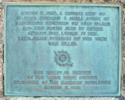
The Battle of Cape Porpoise (Goat Island)
Photographed by William Fischer, Jr., September 26, 2011
1. The Battle of Cape Porpoise (Goat Island) Marker
This tablet was erected August 8, 1921.
Erected 1921 by Maine State Council, Daughters of the American Revolution.
Topics and series. This historical marker is listed in these topic lists: Fraternal or Sororal Organizations • Patriots & Patriotism • War, US Revolutionary. In addition, it is included in the Daughters of the American Revolution (DAR) series list. A significant historical year for this entry is 1782.
Location. 43° 21.949′ N, 70° 25.868′ W. Marker is in Cape Porpoise, Maine, in York County. It is on Pier Road, on the left when traveling south. Marker is at a scenic lookout adjacent to the parking lot at the end of Pier Road. Touch for map. Marker is at or near this postal address: 77 Pier Road, Cape Porpoise ME 04014, United States of America. Touch for directions.

Regionally, this marker is on Southern Maine Coast. It is also in the American Northeast, in New England, and on the Eastern
this page online
Other nearby markers. At least 8 other markers are within 3 miles of this marker, measured as the crow flies: Veterans Memorial (approx. 0.6 miles away); Our President George H. W. Bush (approx. 2.2 miles away); Anchor to Windward Monument (approx. 2.2 miles away); Soldiers and Sailors Memorial (approx. 2.3 miles away); Kennebunk River Drawbridge (approx. 2.4 miles away); Shipbuilding along the Kennebunk River (approx. 2.4 miles away); Bridge changes as town evolves (approx. 2.4 miles away); Vatican Pavilion Sculpture (approx. 2½ miles away).
Also see . . . The Revolutionary War Battle of Cape Porpoise, Maine. (Submitted on May 25, 2012, by William Fischer, Jr. of Reynoldsburg, Ohio.)
Photographed by William Fischer, Jr., September 26, 2011
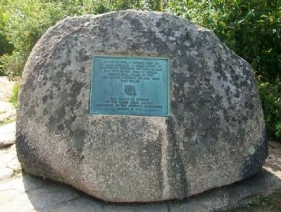
2. The Battle of Cape Porpoise (Goat Island) Marker
Photographed by William Fischer, Jr., September 26, 2011
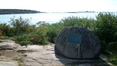
3. The Battle of Cape Porpoise (Goat Island) Marker
Photographed by William Fischer, Jr., September 26, 2011
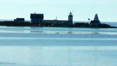
4. Goat Island and Lighthouse
Photographed by William Fischer, Jr., September 26, 2011
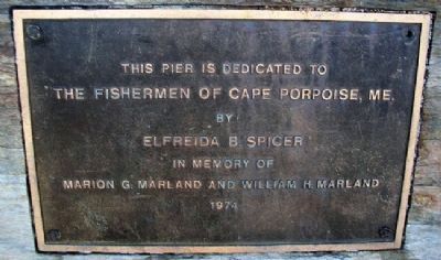
5. The Fishermen of Cape Porpoise, Me. Marker
Photographed by William Fischer, Jr., September 26, 2011
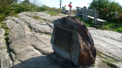
6. The Fishermen of Cape Porpoise, Me. Marker
Credits. This page was last revised on June 16, 2016. It was originally submitted on May 25, 2012, by William Fischer, Jr. of Reynoldsburg, Ohio. This page has been viewed 1,645 times since then and 63 times this year. Photos: 1, 2, 3, 4, 5, 6. submitted on May 25, 2012, by William Fischer, Jr. of Reynoldsburg, Ohio.
