Canadian in Hemphill County, Texas — The American South (West South Central)
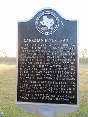
Canadian River Trails
Photographed by Bill Kirchner, March 17, 2016
1. Canadian River Trails Marker
Hunters, cattlemen, settlers used Canadian River Trails in 1870's and 80's, as Panhandle was opened to civilization.
River's name, “Canadian,” came from Spanish for “boxed-in.”
Erected 1966 by State Historical Survey Committee. (Marker Number 697.)
Topics. This historical marker is listed in these topic lists: Exploration • Roads & Vehicles. A significant historical year for this entry is 1541.
Location. 35° 55.402′ N, 100° 22.613′ W. Marker is in Canadian, Texas, in Hemphill County. It is on U.S. 60 north of 6th Street, on the right when traveling west. Marker is in city park at north end of town. Touch for map. Marker is in this post office area: Canadian TX 79014, United States of America. Touch for directions.

Regionally,
this page online
Other nearby markers. At least 8 other markers are within walking distance of this marker: Hemphill County (here, next to this marker); Robert R. Young (here, next to this marker); Quanah Parker Trail (a few steps from this marker); Edith Ford Memorial Cemetery (approx. 0.7 miles away); Tom T. McGee (approx. 0.7 miles away); The Former Canadian Hospital (approx. ¾ mile away); First National Bank of Canadian (approx. ¾ mile away); Moody Hotel (approx. ¾ mile away). Touch for a list and map of all markers in Canadian.
Additional commentary.
1. Origin of the name of the Canadian River
The marker states that the origin of the name of the Canadian River comes from the Spanish word for "boxed-in", which may be "cañada" or even
Photographed by Bill Kirchner, May 2, 2012
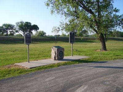
2. Canadian River Trails Marker at far left
— Submitted April 4, 2016, by J. Makali Bruton of Washington, District of Columbia.
Credits. This page was last revised on March 12, 2018. It was originally submitted on May 28, 2012, by Bill Kirchner of Tucson, Arizona. This page has been viewed 816 times since then and 34 times this year. Photos: 1. submitted on April 5, 2016, by Bill Kirchner of Tucson, Arizona. 2. submitted on May 28, 2012, by Bill Kirchner of Tucson, Arizona. • Bernard Fisher was the editor who published this page.
