Foxborough in Norfolk County, Massachusetts — The American Northeast (New England)
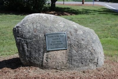
Wading River Farm
Location of
First house in Foxborough
1670
Erected by Foxboro Historical Commission.
Topics. This historical marker is listed in these topic lists: Colonial Era • Settlements & Settlers. A significant historical year for this entry is 1670.
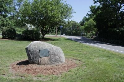
Location. 42° 1.466′ N, 71° 16.405′ W. Marker is in Foxborough, Massachusetts, in Norfolk County. Marker is at the intersection of South Street and Cedar Street, in the median on South Street. Touch for map. Marker is at or near this postal address: 472 South St, Foxboro MA 02035, United States of America. Touch for directions.
Other nearby markers. At least 8 other markers are within 3 miles of this marker, measured as the crow flies. First Settler / Roads and Boundaries (here, next to this marker); The Dorchester School Farm (approx. 1.1 miles away); The Lodge at Foxborough (approx. 2.4 miles away); Paineburgh-Foxvale (approx. 2˝ miles away); The Town Lot (approx. 2.7 miles away); Mansfield Veterans Memorial (approx. 2.8 miles away); Historic Town Hall Clock (approx. 2.8 miles away); Lowney Common (approx. 2.8 miles away). Touch for a list and map of all markers in Foxborough.
Credits. This page was last revised on November 24, 2020. It was originally submitted on May 31, 2012, by Bryan Simmons of Attleboro, Massachusetts. This page has been viewed 558 times since then and 17 times this year. Photos: 1, 2. submitted on May 31, 2012, by Bryan Simmons of Attleboro, Massachusetts. • Bill Pfingsten was the editor who published this page.

