Panhandle in Carson County, Texas — The American South (West South Central)
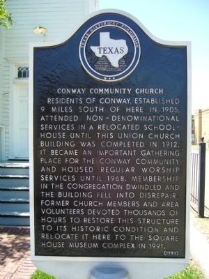
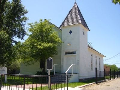
Conway Community Church
Erected 1993 by Texas Historical Commission. (Marker Number 1046.)
Topics. This historical marker is listed in this topic list: Churches & Religion. A significant historical year for this entry is 1905.
Location. 35° 20.733′ N, 101° 22.766′ W. Marker is in Panhandle, Texas, in Carson County. Marker is on Elsie Avenue (State Highway 207) south of East 5th Street, on the right when traveling south. Touch for map. Marker is at or near this postal address: 405 Elsie Avenue, Panhandle TX 79068, United States of America. Touch for directions.
Other nearby markers. At least 8 other markers are within walking distance of this marker. The Square House (about 300 feet away, measured in a direct line); Purvines Ranch Home (about 300 feet away); Texas Panhandle Pioneers: The Simms Brothers (about 300 feet away); Pioneer Dugout (about 300 feet away); Eclipse Windmill Patented 1867 (about 300 feet away); Last Great Panhandle Cattle Drive to Montana (about 400 feet away); Finch-Lord-Nelson and the Founding of Panhandle City (about 400 feet away); Farm and Ranch Building (about 400 feet away). Touch for a list and map of all markers in Panhandle.
Credits. This page was last revised on June 16, 2016. It was originally submitted on June 1, 2012, by Bill Kirchner of Tucson, Arizona. This page has been viewed 605 times since then and 31 times this year. Photos: 1, 2. submitted on June 1, 2012, by Bill Kirchner of Tucson, Arizona. • Bernard Fisher was the editor who published this page.

