Bainbridge in Decatur County, Georgia — The American South (South Atlantic)
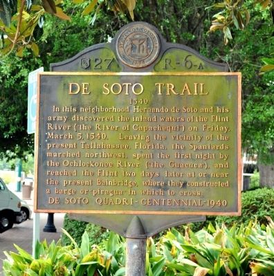
De Soto Trail
1540
In this neighborhood Hernando de Soto and his army discovered the inland waters of the Flint River (“the River of Capachequi”) on Friday, March 5, 1540. Leaving the vicinity of the present Tallahassee, Florida, the Spaniards marched northwest, spent the first night by the Ochlockonee River (“the Guacuca”), and reached the Flint two days later at or near the present Bainbridge, where they constructed a barge or “piragua” in which to cross.
Erected 1940 by Works Progress Administration for the De Soto Quadri-Centennial 1940. (Marker Number 27 R-6-A.)
Topics and series. This historical marker is listed in this topic list: Exploration. In addition, it is included in the Georgia Historical Society, and the Works Progress Administration (WPA) projects series lists. A significant historical date for this entry is March 5, 1778.
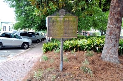
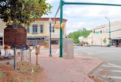
Location. 30° 54.382′ N, 84° 34.547′ W. Marker is in Bainbridge, Georgia, in Decatur County. Marker is at the intersection of North Broad Street (Business U.S. 27) and East Water Street, on the left when traveling north on North Broad Street. The marker is at the northeast corner of Willis Park. Touch for map. Marker is in this post office area: Bainbridge GA 39817, United States of America. Touch for directions.
Other nearby markers. At least 8 other markers are within walking distance of this marker. The Bainbridge Volunteers (within shouting distance of this marker); El Camino Real (within shouting distance of this marker); In Memory of Revolutionary Soldiers (within shouting distance of this marker); Decatur County (about 300 feet away, measured in a direct line); First Presbyterian Church (about 500 feet away); Camp Recovery (approx. 0.2 miles away); The J.D. Chason Memorial Park / The J.D. Chason Memorial Park History (approx. 0.2 miles away); Fort Scott Memorial (approx. 0.2 miles away). Touch for a list and map of all markers in Bainbridge.
Also see . . . Hernando de Soto in Georgia. New Georgia Encyclopedia website entry (Submitted on June 3, 2012, by David Seibert of Sandy Springs, Georgia.)
Credits. This page was last revised on November 24, 2021. It was originally submitted on June 2, 2012, by David Seibert of Sandy Springs, Georgia. This page has been viewed 737 times since then and 38 times this year. Photos: 1, 2, 3. submitted on June 2, 2012, by David Seibert of Sandy Springs, Georgia. • Craig Swain was the editor who published this page.


