Near Stafford in Stafford County, Virginia — The American South (Mid-Atlantic)
Redoubt No. 2
⎯⎯⎯
Fort No Name
Federal Defenses of Aquia Creek Landing
July 10, 2012
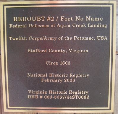
1. Redoubt No. 2 / Fort No Name Marker
Stafford County, Virginia
Circa 1863
National Historic Registry
February 2006
Virginia Historic Registry
DHR # 089-5057/44ST0082
Topics. This historical marker is listed in these topic lists: Forts and Castles • War, US Civil. A significant historical month for this entry is February 2006.
Location. 38° 23.599′ N, 77° 21.349′ W. Marker is near Stafford, Virginia, in Stafford County. It is on Old Fort Lane 0.1 miles south of Courthouse Road (State Route 630), on the right when traveling east. Touch for map. Marker is in this post office area: Stafford VA 22554, United States of America. Touch for directions.

Regionally, this marker is in the Washington Metropolitan Area, in Northern Virginia, and in the Piedmont. It is also in the American South, specifically in the Upper South, in the Mid-Atlantic, and on the Eastern Seaboard. Globally, it is in the North Atlantic Region, North America, the Western Hemisphere, the Western World, and the Anglosphere. Historically, it finds itself in what was once the territory of the Mississippian Culture, one of the original Thirteen
this page online
Other nearby markers. At least 8 other markers are within 2 miles of this marker, measured as the crow flies: Redoubt # 2 (approx. one mile away); Union XIIth Corps Winter Camp (approx. 1.4 miles away); Union Redoubt # 3 (approx. 1.6 miles away); Union Redoubt No. 3 (approx. 1.7 miles away); Mt. Hope Baptist Church (approx. 1.7 miles away); Palmer Hayden (approx. 1.9 miles away); John Smith Explores the Chesapeake (approx. 2 miles away); Crow's Nest Natural Area Preserve / Virginia’s State Natural Area Preserves (approx. 2 miles away). Touch for a list and map of all markers in Stafford.
Another marker is no longer nearby. Brooke, Virginia (was approx. 1.4 miles away but has been confirmed missing).
Also see . . . Historical Research into Redoubt No. 2/Fort No Name. Provided to the Historical Marker database courtesy of Dr. Mountz. For more information, Dr. Mountz has provided an email address on the cover page. (Submitted on July 22, 2012.)
July 10, 2012
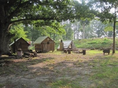
2. Redoubt No. 2 / Fort No Name Marker
Marker is on the center hut.
Photographed by Shane Oliver, January 12, 2022
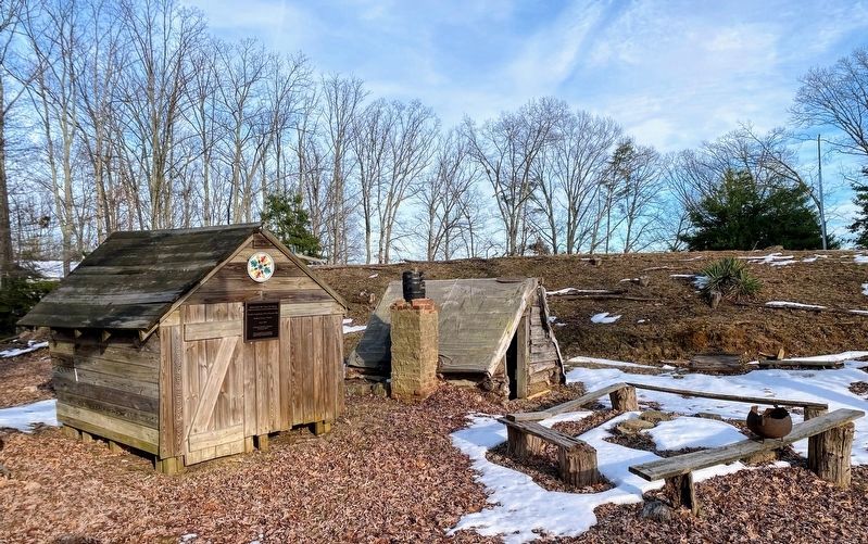
3. Redoubt No. 2 / Fort No Name Marker
Marker can be seen on one of the reconstructed camp huts.
July 10, 2012
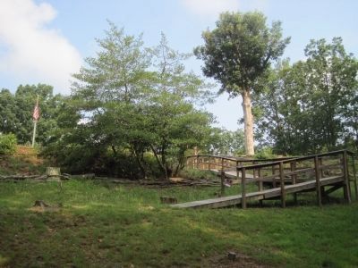
4. Entrance to the Redoubt
Ramp is not representative of the original fort. It is there to make the fort accessible to the handicapped.
July 10, 2012
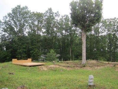
5. Redoubt No. 2 / Fort No Name
Reconstructed artillery platform on the left. The remains of the fort's powder bunker is at the base of the tree.
July 10, 2012
6. Redoubt No. 2 / Fort No Name
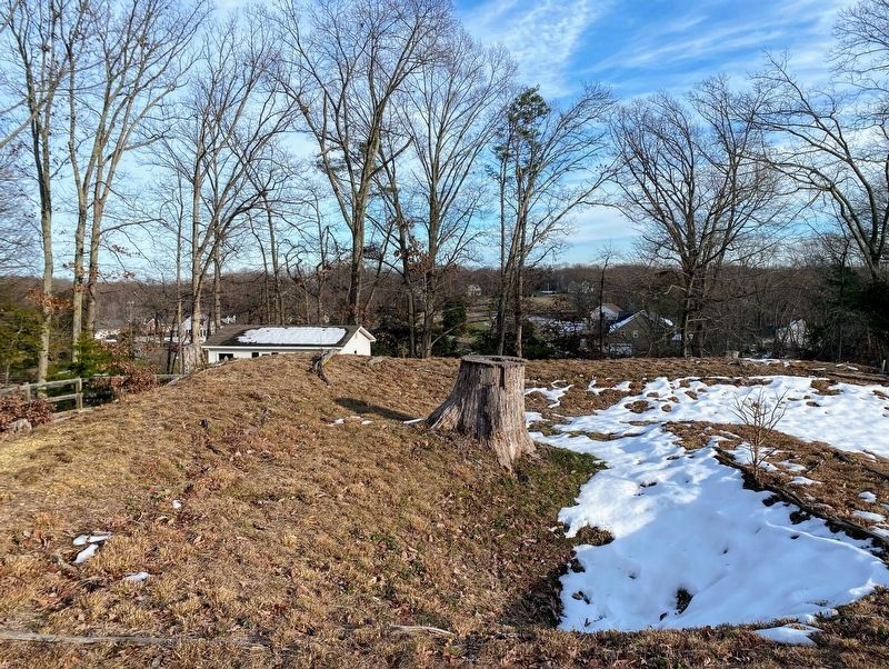
Photographed by Shane Oliver, January 12, 2022
7. Redoubt No. 2 / Fort No Name Interior
This corner of the redoubt is believed to have contained a powder magazine.
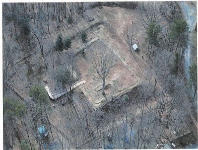
8. Overhead picture of Redoubt No. 2
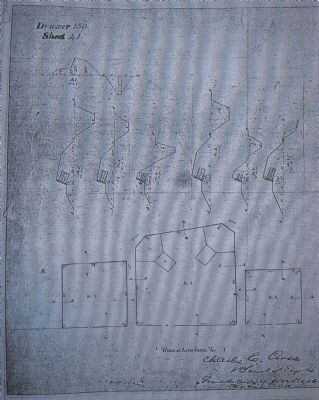
9. Copy of Civil War era engineering drawing of the three redoubts in the Aquia area.
July 10, 2012
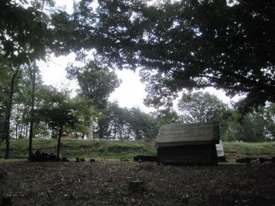
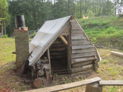
10. Redoubt No. 2 / Fort No Name Marker
Reconstructed hut, typical of that constructed by both Union and Confederate soldiers during the Civil War.
Credits. This page was last revised on June 22, 2022. It was originally submitted on June 4, 2012. This page has been viewed 1,252 times since then and 24 times this year. Photos: 1, 2. submitted on July 10, 2012. 3. submitted on May 23, 2022, by Shane Oliver of Richmond, Virginia. 4, 5, 6. submitted on July 10, 2012. 7. submitted on May 23, 2022, by Shane Oliver of Richmond, Virginia. 8, 9, 10. submitted on July 10, 2012. • Craig Swain was the editor who published this page.
