Wheeling in Ohio County, West Virginia — The American South (Appalachia)
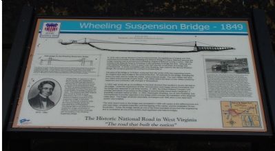
Wheeling Suspension Bridge - 1849
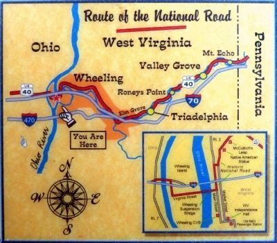
Historic National Road
In 1816, with a strong interest in internal improvements, the legislatures of Virginia and Ohio authorized the formation of the Wheeling and Belmont Bridge Company (Belmont because the bridge company was to connect from Wheeling, Virginia to Belmont County in Ohio). With the coming of the National Road to Wheeling, it was necessary to bridge the Ohio. Although the road reached Wheeling in 1818, it wasn't until 1847 that the construction of a bridge was commissioned. In sharp competition with John Roebling, later noted for the famous Brooklyn Bridge, the company granted the contract to Charles Ellet, Jr.
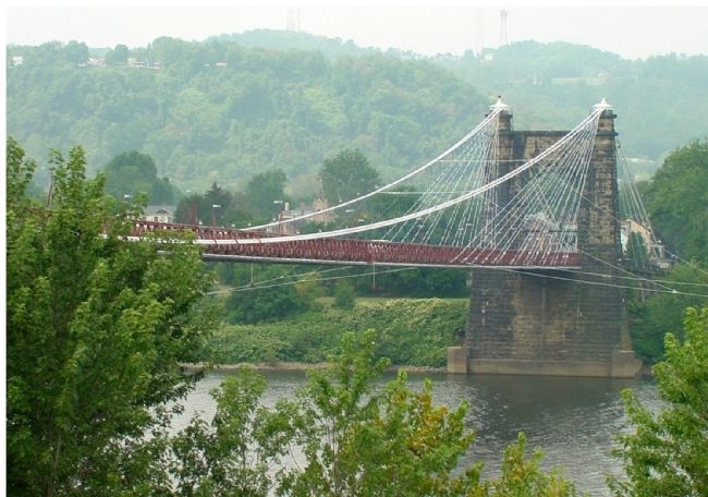
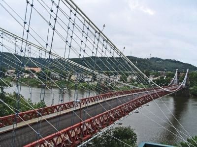
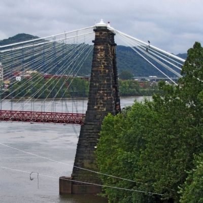
The span of the bridge is 1010 feet, measured from the center of the two supporting towers—the longest clear-span bridge in the world at the time. All the materials for the bridge, including the drawn iron wire used to create the cables, were produced locally. The main cables rest upon iron rollers at the summits of each tower. The rollers relieve the strain on the cables caused by expansion and contraction with the changes in temperature.
In 1854, high winds set up an oscillation in the deck structure that resulted in severe damage to the bridge. Under the supervision of Ellet, reconstruction work began almost immediately and the bridge was reopened in just three months. In 1867 the Citizen Railway Company was granted permission to lay tracks on the bridge to accommodate horse-drawn streetcars, a possibility indicated earlier by Ellet. In 1872, Washington Roebling, son of John Roebling, was commissioned to provide upgrades to the bridge which included the installation of diagonal cable stays. The bridge remained essentially unchanged until 1956 when a new steel deck system was installed.
The most recent work on the bridge was completed in 1999 with repairs to the stiffening truss and wire rope stays, complete inspection and rewrapping of the cables, and the installation of new illumination. Today, the bridge stands as one of the finest example of pre-Civil War engineering and is considered as one of the world's most significant and historic bridges.
(left sidebar) Charles Ellet, Jr., was born in 1810 in Bucks County, near Philadelphia. The young Ellet had little interest in farming and in 1827 left home to join a survey of the Susquehanna River. In 1828 he gained employment on the Chesapeake and Ohio Canal and rose to the position of assistant engineer by 1829. The following year Ellet resigned and moved to France to study. Returning to the U.S. in 1832, Ellet became a leading proponent of wire suspension bridge construction. In 1841, he won the contract to build the Fairmount Bridge across the Schuylkill River at Philadelphia. This placed Ellet in the forefront of wire suspension bridge construction in America, a position further enhanced with the building of the Wheeling Suspension Bridge.
(right sidebar) On November 10, 1849, just five days before the official opening of the bridge, the water level at the bridge rose 20 feet. The steamboat, Messenger, on its way upstream to Pittsburgh, had to cut almost 8 feet from her smoke stacks to pass under the bridge. The following day the Hibernia #2 was likewise impaired but waited for the water level to drop before continuing upstream. Armed with these and similar events, the State of Pennsylvania, on behalf of the city of Pittsburgh, filed a case in federal court to either have the bridge removed or elevated, the argument being that it was an obstruction to river traffic. In May of 1852, the U.S. Supreme Court decided in favor of Pennsylvania. The bridge either had to be elevated or removed by February 1, 1853. The battle for the bridge moved to Congress. The Bridge Company successfully lobbied the House Committee of Post Office and Post Roads to have the bridge designated as a post and military road. By the end of August 1852, the House passed legislation legalizing the bridge and thus fixing its height and location. Finally, in 1856, after another legal challenge to the bridge by Pennsylvania, the Supreme Court recognized the Congressional action and ruled in favor of the bridge.
Of course, by this time the height of the bridge was largely irrelevant since most steamboats had hinged stacks that could be lowered to pass under bridges.
Topics and series. This historical marker is listed in this topic list: Bridges & Viaducts. In addition, it is included in the ASCE Civil Engineering Landmarks, and the The Historic National Road series lists. A significant historical month for this entry is February 1892.
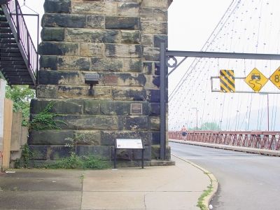
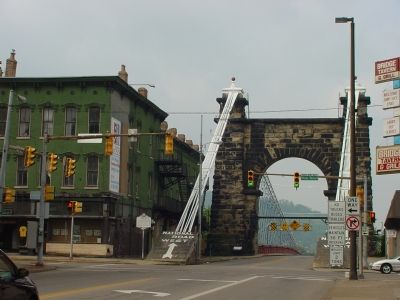
Location. 40° 4.22′ N, 80° 43.505′ W. Marker is in Wheeling, West Virginia, in Ohio County. Marker is on 10th Street west of Main Street (U.S. 40), on the left when traveling west. Marker is at the base of the eastern tower. Touch for map. Marker is in this post office area: Wheeling WV 26003, United States of America. Touch for directions.
Other nearby markers. At least 8 other markers are within walking distance of this marker. Old Trails Road (a few steps from this marker); Wheeling Suspension Bridge (within shouting distance of this marker); a different marker also named Wheeling Suspension Bridge (within shouting distance of this marker); Fort Henry (about 400 feet away, measured in a direct line); Robert W. Hazlett House (about 400 feet away); Wheeling (about 500 feet away); Slave Auction Block (about 500 feet away); Marsh Wheeling Stogies (about 600 feet away). Touch for a list and map of all markers in Wheeling.
More about this marker. This is one of a series of National Road,
Photographed By J. J. Prats
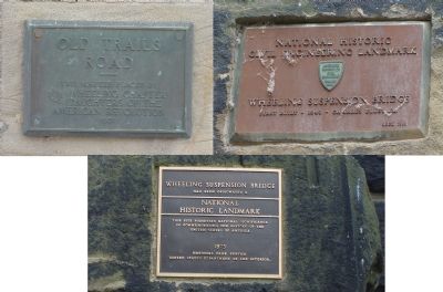
4. Plaques on Bridge Tower
Old Trails Road. This marker placed by Wheeling Chapter, Daughters of the American Revolution, 1921.
National Historic Civil Landmark. Wheeling Suspension Bridge. First Built – 1849 – Charles Ellet, Jr. American Society of Civil Engineers, 1969.
Wheeling Suspension Bridge has been designated a National Historic Landmark. This site possesses national significance in commemorating the history of the United States of America. 1975, National Park Service, United States Department of the Interior.
Also see . . .
1. Wheeling Suspension Bridge. American Society of Civil Engineers website entry (Submitted on February 1, 2022, by Larry Gertner of New York, New York.)
2. Terrific Storm! Destruction of the Wheeling Suspension Bridge!!. Ohio County Public Library website entry:
1854 article from the Wheeling Daily Intelligencer. (Submitted on October 1, 2006.)
Photographed By Allen C. Browne, December 30, 2013
9. The Wheeling Bridge Case (Sidebar)
On November 10th, 1849, just five days before the official opening of the bridge, the water level at the bridge rose 20 feet. The steamboat Messenger, on its way upstream to Pittsburgh, had cut almost 8 feet from her smoke stacks to pass under the bridge. The following day the Hibernia #2 was likewise impaired but waited for the water level to drop before continuing upstream. Armed with these and similar events, the state of Pennsylvania, on behalf of Pittsburgh, filed a case in federal court to either have the bridge removed or elevated,the argument being that is was an obstruction to river traffic. In May 1852, the U.S. Supreme Court decided in favor of Pennsylvania. The bridge had to be elevated or removed by February 1, 1853. The battle fro the bridge moved to Congress. The Bridge Company successfully lobbied the House Committee on Post Office and Post Roads to have the bridge designated as a post and military road. By the end of August 1852, the House passed legislation legalizing the bridge and thus fixing its height and location. Finally, in 1856, after another legal challenge to the bridge by Pennsylvania, the Supreme Court recognized the Congressional action and ruled in favor of the bridge. Of course, by this time the height of the bridge was largely irrelevant since most steamboats had hinged stacks that could be lowered to pass under bridges.Close-up of sidebar on marker

Photographed By Allen C. Browne, December 30, 2013
10. 1836 design for the Wheeling Suspension Bridge
Throughout his career, Charles Ellet produced numerous "reports" that proposed the construction of suspension bridges. It was during the 1830s that he became interested in the possibility of bridging the Ohio River. In 1836, while he was in Lynchburg, Virginia, having never visited Wheeling, Ellet created his first design for a suspension bridge at Wheeling. As seen in the above drawing, it consisted of a 500 foot center span flanked by two 100 foot side arch spans.Close-up of image on marker
Credits. This page was last revised on August 19, 2023. It was originally submitted on October 1, 2006, by J. J. Prats of Powell, Ohio. This page has been viewed 4,032 times since then and 60 times this year. Last updated on August 17, 2023, by Carl Gordon Moore Jr. of North East, Maryland. Photos: 1, 2. submitted on October 1, 2006, by J. J. Prats of Powell, Ohio. 3. submitted on September 17, 2006, by J. J. Prats of Powell, Ohio. 4, 5. submitted on October 1, 2006, by J. J. Prats of Powell, Ohio. 6, 7, 8. submitted on April 13, 2013, by Allen C. Browne of Silver Spring, Maryland. 9, 10, 11, 12. submitted on January 5, 2014, by Allen C. Browne of Silver Spring, Maryland. • Bill Pfingsten was the editor who published this page.
