McLean in Fairfax County, Virginia — The American South (Mid-Atlantic)
Odrick’s Corner
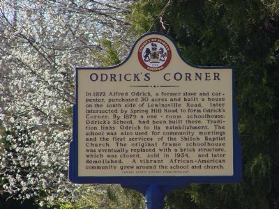
Photographed by J. J. Prats, March 18, 2006
1. Odrick's Corner Marker
Erected 2001 by Fairfax County History Commission.
Topics and series. This historical marker is listed in these topic lists: African Americans • Education • Religion & Religious Structures • Settlements & Settlers. In addition, it is included in the Virginia, Fairfax County History Commission series list. A significant historical year for this entry is 1872.
Location. 38° 56.384′ N, 77° 13.785′ W. Marker is in McLean, Virginia, in Fairfax County. It is at the intersection of Lewinsville Road (County
this page online

Regionally, this marker is in the Washington Metropolitan Area and in Northern Virginia. It is also in the American South, specifically in the Upper South, in the Mid-Atlantic, and on the Eastern Seaboard. Globally, it is in the North Atlantic Region, North America, the Western Hemisphere, the Western World, and the Anglosphere. Historically, it finds itself in what was once the territory of the Mississippian Culture, one of the original Thirteen Colonies, one of the Confederate States of America, and the Antebellum South.
Other nearby markers. At least 8 other markers are within 2 miles of this marker, measured as the crow flies: A Fairfax Legacy (approx. 1.2 miles away); Ash Grove (approx. 1.2 miles away); First Court House of Fairfax County (approx. 1.7 miles away); A Union Spy of Color? (approx. 1.7 miles away); Family Strength (approx. 1.7 miles away);
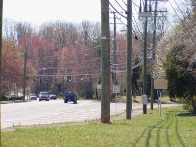
Photographed by J. J. Prats, March 18, 2006
2. Odrick's Corner Marker
Another marker is no longer nearby. Freedom Hill Redoubt (was approx. 1.7 miles away but has been confirmed missing).
Also see . . . Odrick's Corner Located with Historic Marker. Newspaper Article with background information on Alfred Odrick and Odrick's Corner. (Submitted on March 18, 2006.)
Credits. This page was last revised on July 14, 2019. It was originally submitted on March 18, 2006, by J. J. Prats of Powell, Ohio. This page has been viewed 4,782 times since then and 172 times this year. Last updated on February 22, 2008, by Christopher Busta-Peck of Shaker Heights, Ohio. Photos: 1, 2. submitted on March 18, 2006, by J. J. Prats of Powell, Ohio. • Kevin W. was the editor who published this page.
