Near Lake Arthur in Chaves County, New Mexico — The American Mountains (Southwest)
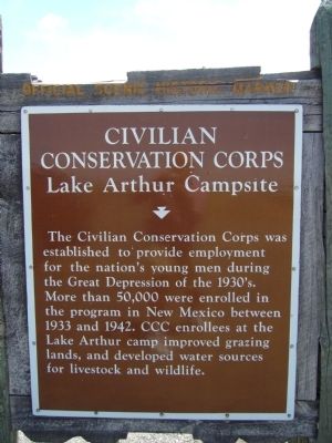
Civilian Conservation Corps
Lake Arthur Campsite
Erected by New Mexico Historic Preservation Division.
Topics and series. This historical marker is listed in these topic lists: Agriculture • Charity & Public Work. In addition, it is included in the Civilian Conservation Corps (CCC) series list. A significant historical year for this entry is 1933.
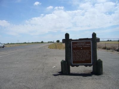
Location. 32° 59.014′ N, 104° 26.399′ W. Marker is near Lake Arthur, New Mexico, in Chaves County. Marker is on U.S. 285, one mile north of State Road 438, on the right when traveling south. Touch for map. Marker is in this post office area: Lake Arthur NM 88253, United States of America. Touch for directions.
Other nearby markers. At least 8 other markers are within 10 miles of this marker, measured as the crow flies. Artesia (approx. 6.4 miles away); Blackdom Townsite (approx. 7.8 miles away); The Sallie Chisum Robert House (approx. 9.9 miles away); The Acord-Wheatley House (approx. 10 miles away); The Illinois #3 (approx. 10 miles away); Van Stratton Welch (approx. 10 miles away); Martin Yates, Jr. (approx. 10 miles away); John R. Gray (approx. 10 miles away).

Photographed By Bill Kirchner, May 3, 2012
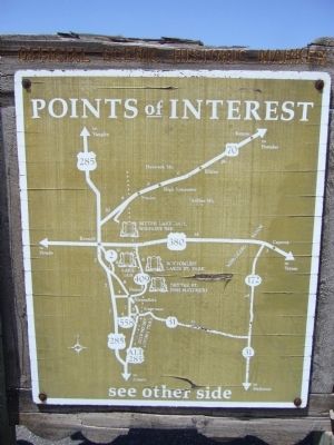
2. Back of Civilian Conservation Corps Marker
Points of Interest
New Mexico's Historic Markers typically have a map on the back side showing the location of other OSHM's. This is an excellent source of information when exploring for other Historical Markers and locations.
New Mexico's Historic Markers typically have a map on the back side showing the location of other OSHM's. This is an excellent source of information when exploring for other Historical Markers and locations.
Credits. This page was last revised on June 16, 2016. It was originally submitted on June 8, 2012, by Bill Kirchner of Tucson, Arizona. This page has been viewed 976 times since then and 28 times this year. Photos: 1, 2, 3. submitted on June 8, 2012, by Bill Kirchner of Tucson, Arizona. • Syd Whittle was the editor who published this page.

