Near Sharpsburg in Washington County, Maryland — The American Northeast (Mid-Atlantic)
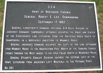
Army of Northern Virginia
Army of Northern Virginia
General Robert E. Lee, Commanding
September 17, 1862.
General Longstreet's Command, including D.H. Hill's Division of Jackson's Command, temporarily attached, occupied the right and center of the Confederate line, extending from the Antietam Creek South of Sharpsburg, in a northerly direction to Mumma's House.
General Jackson's Command occupied the left of the line extending from Mumma's House to the Hagerstown Pike, north of the Dunkard Church thence through the West Woods to the open fields south of Nicodemus' House.
General Stuart's Cavalry Division covered the extreme left of the Army, extending from Jackson's left westerly to the Potomac River.
Erected by Antietam Battlefield Board. (Marker Number 351.)
Topics and series. This historical marker is listed in this topic list: War, US Civil. In addition, it is included in the Antietam Campaign War Department Markers series list. A significant historical date for this entry is September 17, 1862.
Location. 39° 28.173′ N, 77° 44.172′ W. Marker is near Sharpsburg, Maryland, in Washington County. Marker is on Richardson Avenue, on the left when traveling east. Located at a tablet cluster near the Sunken Road next to the observation tower, stop eight on the driving tour of Antietam. Touch for map. Marker is in this post office area: Sharpsburg MD 21782, United States of America. Touch for directions.
Other nearby markers. At least 8 other markers are within walking distance of this marker. A different marker also named Army of Northern Virginia (here, next to this marker); a different marker also named Army of Northern Virginia (here, next to this marker); September 17, 1862 (Continued) (here, next to this marker); a different marker also named September 17, 1862 (Continued) (here, next to this marker); September 17, 1862 (a few steps from this marker); Hexamer's (New Jersey) Battery (a few steps from this marker); September 16, 1862 (a few steps from this marker); Army of the Potomac (a few steps from this marker). Touch for a list and map of all markers in Sharpsburg.
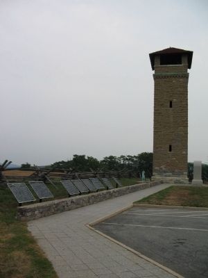
More about this marker. One of three tablets erected at this location to describe the activities of the Army of Northern Virginia from September 15-17, 1862. This, the last of the set, is out of sequence and should logically be sited in the middle.
Also see . . . Antietam Battlefield. National Park Service site. (Submitted on February 22, 2008, by Craig Swain of Leesburg, Virginia.)
Credits. This page was last revised on March 8, 2021. It was originally submitted on February 22, 2008, by Craig Swain of Leesburg, Virginia. This page has been viewed 1,057 times since then and 21 times this year. Last updated on March 7, 2021, by Carl Gordon Moore Jr. of North East, Maryland. Photos: 1. submitted on February 22, 2008, by Craig Swain of Leesburg, Virginia. 2. submitted on September 27, 2015, by Brian Scott of Anderson, South Carolina. 3. submitted on February 20, 2008, by Craig Swain of Leesburg, Virginia. 4. submitted on September 27, 2015, by Brian Scott of Anderson, South Carolina. • Bill Pfingsten was the editor who published this page.


