Near Sharpsburg in Washington County, Maryland — The American Northeast (Mid-Atlantic)
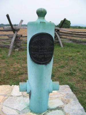
Major General Israel B. Richardson
Israel B. Richardson
U.S.A.
Mortally Wounded
45 Yards N. 32'E.
Topics. This historical marker is listed in this topic list: War, US Civil.
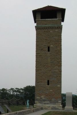
Location. 39° 28.166′ N, 77° 44.166′ W. Marker is near Sharpsburg, Maryland, in Washington County. Marker is on Richardson Avenue, on the left when traveling east. Near the Sunken Road next to the observation tower, stop eight on the driving tour of Antietam. Touch for map. Marker is in this post office area: Sharpsburg MD 21782, United States of America. Touch for directions.
Other nearby markers. At least 8 other markers are within walking distance of this marker. Hexamer's (New Jersey) Battery (here, next to this marker); Irish Brigade (here, next to this marker); War Department Observation Tower (a few steps from this marker); Army of Northern Virginia (a few steps from this marker); a different marker also named Army of Northern Virginia (a few steps from this marker); a different marker also named Army of Northern Virginia (a few steps from this marker); September 17, 1862 (Continued) (a few steps from this marker); a different marker also named September 17, 1862 (Continued) (a few steps from this marker). Touch for a list and map of all markers in Sharpsburg.
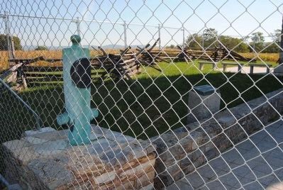
More about this marker. Marker is mounted on a Model 1857 12-pounder Light Field Gun, also known as a "Napoleon."
Regarding Major General Israel B. Richardson. This marker is included on the Sunken Road or Bloody Lane Virtual Tour by Markers see the Virtual tour link below to see the markers in sequence.
Related marker. Click here for another marker that is related to this marker. General Richardson's gravesite.
Also see . . .
1. Six Generals Killed at Antietam. The locations of six generals killed in the battle are marked by muzzle down cannon. General Richardson was wounded by an artillery shell, and died of those wounds on November 3, 1862. (Submitted on February 22, 2008, by Craig Swain of Leesburg, Virginia.)
2. Major General Israel B. Richardson. Biographical sketch of General "Fighting Dick" Richardson. (Submitted on February 22, 2008, by Craig Swain of Leesburg, Virginia.)
Photographed By Craig Swain, December 30, 2006
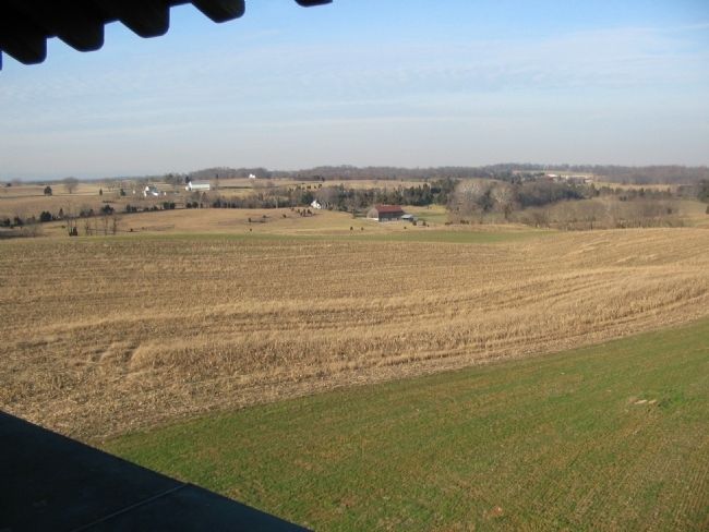
4. Richardson's Division Advance
Seen from the Observation Tower, Richardson moved his division from the Roulette Farm in the distance through the fields in front of the Sunken Road. At a point about 45 yards to the north (in the direction of view), Richardson was mortally wounded while ordering up more artillery to support the advance.
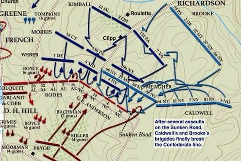
via American Battlefield Trust, unknown
5. Sunken Road or Bloody Lane Virtual Tour by Markers.
A collection of markers interpreting the action of during the Battle of Antietam around the Sunken Road.
(Submitted on February 23, 2008, by Craig Swain of Leesburg, Virginia.)
Click for more information.
(Submitted on February 23, 2008, by Craig Swain of Leesburg, Virginia.)
Click for more information.
Credits. This page was last revised on April 3, 2022. It was originally submitted on February 22, 2008, by Craig Swain of Leesburg, Virginia. This page has been viewed 1,646 times since then and 31 times this year. Photos: 1, 2. submitted on February 22, 2008, by Craig Swain of Leesburg, Virginia. 3. submitted on September 27, 2015, by Brian Scott of Anderson, South Carolina. 4. submitted on February 22, 2008, by Craig Swain of Leesburg, Virginia. 5. submitted on April 3, 2022, by Larry Gertner of New York, New York.
