Jamestown in Newport County, Rhode Island — The American Northeast (New England)
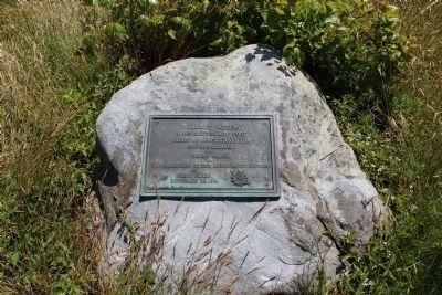
Conanicut Battery
A Revolutionary Fort
Built by Americans in 1776
Grounds cleared and tablet placed by the Daughters of the American Revolution of Rhode Island
Erected 1931 by Daughters of the American Revolution of Rhode Island.
Topics and series. This historical marker is listed in these topic lists: Colonial Era • Forts and Castles • War, US Revolutionary. In addition, it is included in the Daughters of the American Revolution series list. A significant historical year for this entry is 1776.
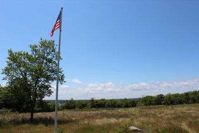
Location. 41° 28.785′ N, 71° 23.666′ W. Marker is in Jamestown, Rhode Island, in Newport County. Marker can be reached from Battery Lane. Follow Battery Lane to the end it will have signs and a large gravel parking lot just follow the path to a field marker is in the field in front of a flag pole with a colonial flag on it. Touch for map. Marker is in this post office area: Jamestown RI 02835, United States of America. Touch for directions.
Other nearby markers. At least 8 other markers are within 3 miles of this marker, measured as the crow flies. Prospect Hill (about 500 feet away, measured in a direct line); Memorial to the Veterans of Jamestown (approx. 1.6 miles away); Fort Wetherill (approx. 1.9 miles away); Harbor Mine (Torpedo) Complex (approx. 1.9 miles away); History of the Dumplings (approx. 1.9 miles away); Oil Storage Building (approx. 2.1 miles away); History of the Beavertail Light Station (approx. 2.1 miles away); Fog Signal Building (approx. 2.1 miles away). Touch for a list and map of all markers in Jamestown.
Credits. This page was last revised on November 2, 2020. It was originally submitted on June 14, 2012, by Bryan Simmons of Attleboro, Massachusetts. This page has been viewed 881 times since then and 24 times this year. Photos: 1, 2, 3. submitted on June 14, 2012, by Bryan Simmons of Attleboro, Massachusetts. • Bill Pfingsten was the editor who published this page.


