Copperopolis in Calaveras County, California — The American West (Pacific Coastal)
Congregational Church
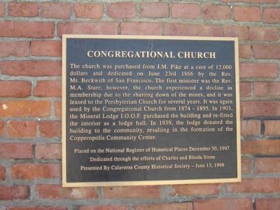
Photographed by Syd Whittle, June 17, 2012
1. Congregational Church Marker
Dedicated through the efforts of Charles and Rhoda Stone
Erected 1998 by Calaveras County Historical Society.
Topics. This historical marker is listed in these topic lists: Fraternal or Sororal Organizations • Religion & Religious Structures. A significant historical date for this entry is June 23, 1866.
Location. 37° 58.779′ N, 120° 38.325′ W. Marker is in Copperopolis, California, in Calaveras County. It can be reached
this page online

Regionally, this marker is in California’s Sierra Nevada. It is also in the American Mountain West. Globally, it is in North America, on the Pacific Rim, in the Western Hemisphere, in the Western World, and in the Anglosphere. Historically, it finds itself in what was once New Spain and also Mexico’s Alta California.
Other nearby markers. At least 8 other markers are within walking distance of this marker: Copperopolis (within shouting distance of this marker); Calaveras Telephone (about 500 feet away, measured in a direct line); a different marker also named Copperopolis (about 600 feet away); The Old Corner Saloon (about 700 feet away); The Copperopolis Bell and Cannon (approx. ¼ mile away); Black Bart at Funk Hill (approx. ¼ mile away); Copperopolis Park (approx. ¼ mile away); Thomas McCarty (approx. 0.3 miles away). Touch for a list and map of all markers in Copperopolis.
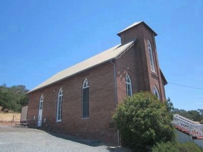
Photographed by Syd Whittle, June 17, 2012
2. Congregational Church and Marker
The marker is mounted on the side of the building just to the left of the large bush.
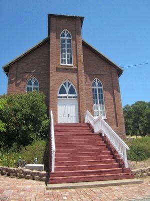
Photographed by Syd Whittle, June 17, 2012
3. Congregational Church
The I.O.O.F cornerstone can be seen on the ground to the left of the steps.
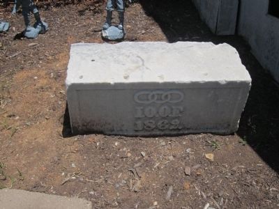
Photographed by Syd Whittle, June 17, 2012
4. I.O.O.F. Cornerstone
Credits. This page was last revised on June 16, 2016. It was originally submitted on June 18, 2012, by Syd Whittle of Mesa, Arizona. This page has been viewed 781 times since then and 31 times this year. Photos: 1, 2, 3, 4. submitted on June 18, 2012, by Syd Whittle of Mesa, Arizona.
