Quincy in Plumas County, California — The American West (Pacific Coastal)
Spanish Creek Mines
Inscription.
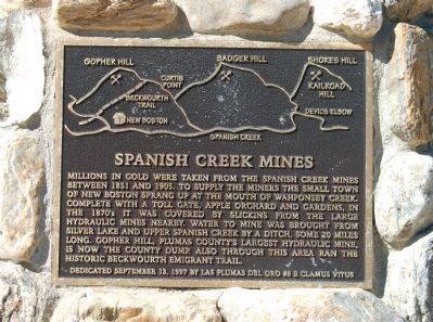
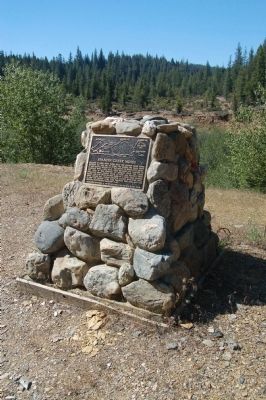
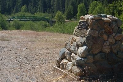
Millions in gold were taken from the Spanish Creek Mines between 1851 and 1905. To supply the miners the small town of New Boston sprang up at the mouth of Wahponsey Creek. Complete with a toll gate, apple orchard and gardens, in the 1870’s it was covered by slickins from the large hydraulic mines nearby. Water to mine was brought from Silver Lake, and Upper Spanish Creek by a ditch, some 20 miles long. Gopher Hill, Plumas County’s largest hydraulic mine, is now the county dump. Also through this area ran the historic Beckwourth Emigrant Trail.
Erected 1997 by E Clampus Vitus, Las Plumas del Oro Chapter No. 8.
Topics and series. This historical marker is listed in these topic lists: Industry & Commerce • Natural Resources. In addition, it is included in the Beckwourth Trail, and the E Clampus Vitus series lists. A significant historical year for this entry is 1851.
Location. 39° 56.962′ N, 121° 2.166′ W. Marker is in Quincy, California, in Plumas County. Marker can be reached from the intersection of Bucks Lake Road (County Route 119) and Snake Lake Road, on the left when traveling east. Touch for map. Marker is in this post office area: Quincy CA 95971, United States of America. Touch for directions.
Other nearby markers. At least 8 other markers are within 5 miles of this marker, measured as the crow flies. Spanish Ranch (approx. 1.1 miles away); Meadow Valley Historical Site (approx. 1.9 miles away); Elizabethtown (approx. 4.3 miles away); Feather Publishing Co. (approx. 4.7 miles away); Plumas County Veterans Memorial (approx. 4.7 miles away); Forest Stationers (approx. 4.7 miles away); World War Memorial (approx. 4.8 miles away); Goodwin Law Office (approx. 4.8 miles away). Touch for a list and map of all markers in Quincy.
Also see . . . Upper Spanish Creek - California Gold. Over the years a lot of gold has been recovered in Plumas County California. At the time of the gold discovery at Sutter’s Mill, Plumas County was largely a unexplored area by most white men, but Peter Lassen (whom Lassen County is named after ) had pioneered the Lassen Trail across northern Plumas in 1847. (Submitted on June 18, 2012, by Barry Swackhamer of Brentwood, California.)
Credits. This page was last revised on June 16, 2016. It was originally submitted on June 18, 2012, by Barry Swackhamer of Brentwood, California. This page has been viewed 748 times since then and 23 times this year. Photos: 1, 2, 3. submitted on June 18, 2012, by Barry Swackhamer of Brentwood, California. • Syd Whittle was the editor who published this page.


