Dixie in Forrest County, Mississippi — The American South (East South Central)
Dixie School Log Cabin
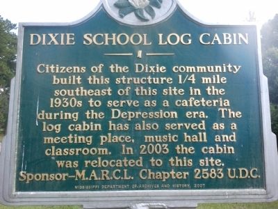
Photographed by Robert M. Cook, Jr., June 17, 2012
1. Dixie School Log Cabin Marker
Erected 2007 by Mississippi Department of Archives and History.
Topics and series. This historical marker is listed in this topic list: Education. In addition, it is included in the Mississippi State Historical Marker Program, and the United Daughters of the Confederacy series lists. A significant historical year for this entry is 2003.
Location. 31° 13.248′ N, 89° 18.284′ W. Marker is in Dixie, Mississippi, in Forrest County. It is at the intersection of Elks Lake Road and Dixie Barn Road on Elks Lake Road. Touch for map. Marker is in this post office area: Hattiesburg MS 39401, United States of America. Touch for directions.

Regionally, this marker is in the Pine Belt. It is also in the American South, specifically in the Deep South, and in the Piney Woods. Globally, it is in North America, a Gulf of Mexico
this page online
Other nearby markers. At least 8 other markers are within 5 miles of this marker, measured as the crow flies: Hi-Hat Club (approx. 4.4 miles away); Bonhomie (approx. 4.6 miles away); The Last Bare Knuckle Prize Fight (approx. 4.7 miles away); Victoria Jackson Gray Adams (approx. 4.7 miles away); Latrine (approx. 5 miles away); Dispensary (approx. 5 miles away); M7 Priest Self-Propelled Gun (approx. 5 miles away); M19 Self-Propelled Anti-Aircraft Gun (approx. 5 miles away).
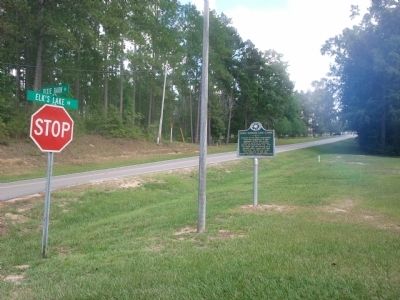
Photographed by Robert M. Cook, Jr., June 17, 2012
2. Dixie School Log Cabin Marker
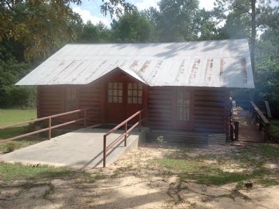
Photographed by Robert M. Cook, Jr., June 17, 2012
3. Dixie School Log Cabin Marker
Credits. This page was last revised on June 16, 2016. It was originally submitted on June 18, 2012, by Robert M. Cook, Jr. of Biloxi, Mississippi. This page has been viewed 1,132 times since then and 29 times this year. Photos: 1, 2, 3. submitted on June 18, 2012, by Robert M. Cook, Jr. of Biloxi, Mississippi. • Craig Swain was the editor who published this page.
