Near Pleasanton in Atascosa County, Texas — The American South (West South Central)
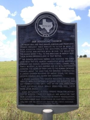
Site of San Augustine Church
The Esparza brothers farmed and ranched the open land near this site. Almost immediately after arriving, Enrique and Manuel constructed a small chapel for family worship. In 1869, Enrique and his wife, Gertrudes, donated five acres of their land to the Roman Catholic Church. About the same time, the Esparzas constructed a larger church building of native stone. The small mission church was named San Augustine.
A storm damaged the church building in 1940 and services were discontinued, although San Augustine was not formally closed until 1942. By the late 1960s, only three exterior rock walls remained, and these were later razed.
Many settlements in Texas sprang from the activities of mission churches such as San Augustine that were located at river crossings or ranch headquarters. Although many have disappeared or have been forgotten, they are an important part of the state's heritage.
Erected 1986 by Texas Historical Commission. (Marker Number 4882.)
Topics. This historical marker is listed in these topic lists: Churches & Religion • Settlements & Settlers. A significant historical month for this entry is March 1836.
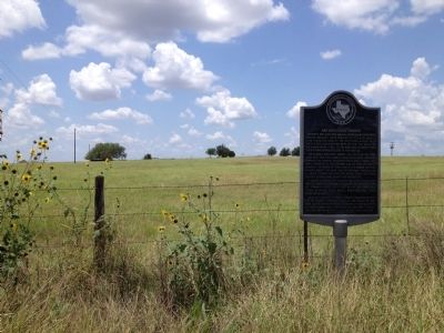
Location. 29° 1.24′ N, 98° 25.91′ W. Marker is near Pleasanton, Texas, in Atascosa County. Marker is on Casarez Road, 0.3 miles north of Crane Road, on the right when traveling south. Touch for map. Marker is in this post office area: Pleasanton TX 78064, United States of America. Touch for directions.
Other nearby markers. At least 8 other markers are within 6 miles of this marker, measured as the crow flies. Brite Cemetery (approx. 2.6 miles away); Verdi (approx. 2.8 miles away); Cooper Chapter No. 101, Royal Arch Masons (approx. 4.7 miles away); Pleasanton First United Methodist Church (approx. 5.1 miles away); Old Rock Schoolhouse (approx. 5.2 miles away); First Baptist Church of Pleasanton (approx. 5.2 miles away); Pleasanton (approx. 5.3 miles away); Pleasanton City Cemetery (approx. 5.3 miles away). Touch for a list and map of all markers in Pleasanton.
Credits. This page was last revised on June 16, 2016. It was originally submitted on June 20, 2012, by John A Hensarling of Campbellton, Texas. This page has been viewed 980 times since then and 55 times this year. Photos: 1, 2. submitted on July 13, 2012, by John A Hensarling of Campbellton, Texas. • Bernard Fisher was the editor who published this page.

