Near Pleasanton in Atascosa County, Texas — The American South (West South Central)
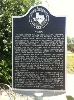
Verdi
Lucas Community was home to a farming and ranching population. They grew and raised their own produce, grains, dairy and meats. Cotton was the chief crop. In 1890, Sydney S. Smith applied for a U.S. post office in Lucas. The name Lucas already was in use elsewhere. According to local legend, French settler Joseph Peynagrosse chose the name Verdi for a river in his homeland. By the early 20th century, Verdi boasted schools, churches, a store, a post office, a blacksmith shop and cotton gins serving a large rural population.
The Lucas school had 101 students in 1904. In 1913 it was called the Verdi school and had 113 students and five teachers. The Verdi post office closed in 1916. The first high school senior class graduated in 1933. In 1954 the school was annexed to Pleasanton and the community declined. It was revived in 1979, when Verdi Community Center was established and became another focal point for the community. The story of the Verdi community is a vital part of Atascosa County's heritage and Texas history.
Erected 2000 by Texas Historical Commission. (Marker Number 11697.)
Topics and series. This historical marker is listed in this topic list: Settlements & Settlers. In addition, it is included in the Postal Mail and Philately series list. A significant historical year for this entry is 1855.
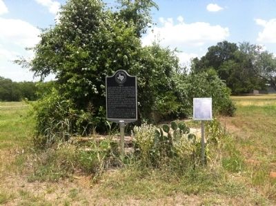
Location. 29° 2.943′ N, 98° 23.962′ W. Marker is near Pleasanton, Texas, in Atascosa County. Marker is at the intersection of Farm to Market Road 1784 and Verdi Road, on the right when traveling north on Route 1784. Touch for map. Marker is in this post office area: Pleasanton TX 78064, United States of America. Touch for directions.
Other nearby markers. At least 8 other markers are within 8 miles of this marker, measured as the crow flies. Site of San Augustine Church (approx. 2.8 miles away); Brite Cemetery (approx. 2.9 miles away); Fairview Methodist Church (approx. 5.3 miles away); Shiloh Cemetery (approx. 7 miles away); Cooper Chapter No. 101, Royal Arch Masons (approx. 7˝ miles away); Pleasanton First United Methodist Church (approx. 7.9 miles away); Old Rock Schoolhouse (approx. 8 miles away); Kings Highway Camino Real — Old San Antonio Road (approx. 8 miles away). Touch for a list and map of all markers in Pleasanton.
Credits. This page was last revised on June 16, 2016. It was originally submitted on June 20, 2012, by John A Hensarling of Campbellton, Texas. This page has been viewed 705 times since then and 12 times this year. Photos: 1, 2. submitted on June 23, 2012, by John A Hensarling of Campbellton, Texas. • Bernard Fisher was the editor who published this page.

