Saugerties in Ulster County, New York — The American Northeast (Mid-Atlantic)
Catskill Mountains
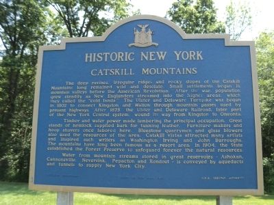
Historic New York
The deep ravines, irregular ridges and rocky slopes of the Catskill Mountains long remained wild and desolate. Small settlements began in mountain valleys before the American Revolution. After the war, population grew steadily as New Englanders streamed into the higher areas, which they called the “cold lands.” The Ulster and Delaware Turnpike was begun in 1802 to connect Kingston and Walton through mountain passes used by present highways. After 1875, the Ulster and Delaware Railroad, later part of the New York Central system, wound its way from Kingston to Oneonta.
Timber and water power made lumbering the principal occupation. Great stands of hemlock supplied bark for tanning leather. Furniture makers and hoop shavers once labored here. Bluestone quarrymen and glass blowers also used the resources of the area. Catskill vistas attracted many artists and inspired such writers as Washington Irving and John Burroughs. The mountains have long been famous as a resort area. In 1885, the State established the Forest Preserve to safeguard forever the natural resources.
Water from mountain streams stored in great reservoirs – Ashokan, Cannonsville, Neversink, Pepacton and Rondout – is conveyed by aqueducts and tunnels to supply New York City.
Erected 1965 by State of New York Education Department, N.Y.S. Thruway Authority.
Topics and series. This historical marker is listed in this topic list: Natural Features. In addition, it is included in the Historic New York State series list. A significant historical year for this entry is 1802.
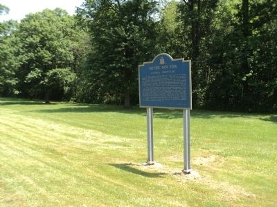
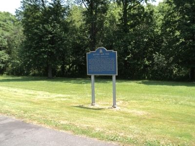
Location. 42° 3.23′ N, 73° 59.002′ W. Marker is in Saugerties, New York, in Ulster County. Marker is on New York State Thruway (Interstate 87), on the right when traveling north. Marker is in a parking area on the New York State Thruway that is used for truck inspections. Touch for map. Marker is in this post office area: Saugerties NY 12477, United States of America. Touch for directions.
Other nearby markers. At least 8 other markers are within 3 miles of this marker, measured as the crow flies. Glasco Turnpike (approx. 1.7 miles away); Brick Church (approx. 2.2 miles away); Post Tavern Site (approx. 2.3 miles away); Kings Road (approx. 2.4 miles away); In Honor (approx. 2.4 miles away); Kiersted House (approx. 2˝ miles away); Flatbush Reformed Church (approx. 2.6 miles away); 1869 Lighthouse (approx. 2.7 miles away). Touch for a list and map of all markers in Saugerties.
Credits. This page was last revised on June 16, 2016. It was originally submitted on June 23, 2012, by Bill Coughlin of Woodland Park, New Jersey. This page has been viewed 649 times since then and 15 times this year. Photos: 1, 2, 3. submitted on June 23, 2012, by Bill Coughlin of Woodland Park, New Jersey.


