Ronda in Wilkes County, North Carolina — The American South (South Atlantic)
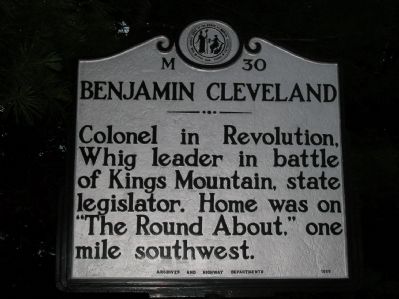
Benjamin Cleveland
Erected 1955 by NC Archives and Highway Departments. (Marker Number M-30.)
Topics and series. This historical marker is listed in these topic lists: Government & Politics • War, US Revolutionary. In addition, it is included in the North Carolina Division of Archives and History series list.
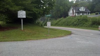
Location. 36° 13.12′ N, 80° 56.63′ W. Marker is in Ronda, North Carolina, in Wilkes County. Marker is at the intersection of Elkin Highway (State Highway 268) and Chatham Street, on the left when traveling west on Elkin Highway. Touch for map. Marker is in this post office area: Ronda NC 28670, United States of America. Touch for directions.
Other nearby markers. At least 8 other markers are within 7 miles of this marker, measured as the crow flies. Richard Allen, Sr. (approx. 3.4 miles away); Stoneman's Raid (approx. 3˝ miles away); The Kings Mountain Campaign of 1780 (approx. 5.1 miles away); Surry County Muster Site (approx. 5.2 miles away); Surry Muster Field (approx. 5.2 miles away); Elkin Manufacturing Company (approx. 5.3 miles away); North Wilkesboro Speedway (approx. 6.2 miles away); Jonesville (approx. 6.8 miles away).
Credits. This page was last revised on March 22, 2021. It was originally submitted on June 25, 2012, by Michael C. Wilcox of Winston-Salem, North Carolina. This page has been viewed 549 times since then and 16 times this year. Photos: 1, 2, 3. submitted on June 25, 2012, by Michael C. Wilcox of Winston-Salem, North Carolina. • Craig Swain was the editor who published this page.


