Adamsville in McNairy County, Tennessee — The American South (East South Central)
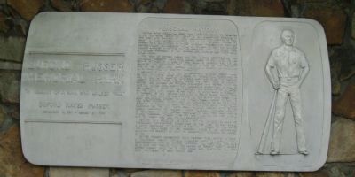
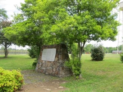
Buford Pusser Memorial Park
"In Memory of a Man Who Walked Tall"
— Buford Hayes Pusser —
— December 13, 1937 - August 21, 1974 —
Personal History
Buford Hayes Pusser was born near Finger, Tennessee on December 12, 1937. His early education consisted of elementary schools in this area and graduation from Adamsville High School in 1956. About a year later, Buford moved to Chicago where he worked as a die cutter, attended Worsham College and wrestled professionally on weekends. While in Chicago he met and married Pauline Mullens, a mother of two children, Mike and Diane from a previous marriage. In 1961, Buford and Pauline had their only child, Dwana.
The saga of Buford Pusser and the illegal activities on the Tennessee-Mississippi state line began early in 1957, when he was beaten severely at a club in that area. In January, 1960, he was arrested for assaulting the owner of a club on the Mississippi side of the state line. Buford received a verdict of innocent at a trial held in Corinth, Mississippi.
Buford's career as a law enforcement officer began when he was appointed Chief-of-Police of Adamsville, Tennessee in 1962. He was later elected constable and then sheriff of McNairy County, serving three terms. During his first year as sheriff, Buford was stabbed on several occasions and along with his deputies raided over forty-two moonshine operations. In 1966, he was forced to shoot in self-defense the operator of a motel on the state line where he had gone to investigate a robbery. In January of 1967, Buford was shot at point blank range four times by two men he had stopped in the state line area. The most deplorable episode in his career began August 12, 1967, in the early morning hours when he, accompanied by his wife, was en route to answer a call to the state line area. They were ambushed on the New Hope Road, killing Pauline with Buford barely surviving the ordeal, being seriously wounded himself. In December of 1968, Buford answered a call for help and a known murderer opened fire on him, leaving him no choice but to shoot and kill him in self-defense.
Buford was selected in 1970, by the Jaycees, as one of Tennessee's "outstanding young men of the year". He had signed a movie contract to depict himself in a sequel to the movie, "Walking Tall", when he was suddenly killed in an automobile accident on Highway 64, west of Adamsville, Tennessee, on August 21, 1974.
Buford Pusser's experiences have inspired three movies, a book, a television series, several magazine articles and a Colt Commemorative Limited Edition handgun, all depicting the life of a man who "walked tall". The legend of McNairy County Sheriff Buford Pusser lives on in the minds and hearts of all who were privileged to have known him.
Topics. This historical marker is listed in these topic lists: Arts, Letters, Music • Entertainment • Industry & Commerce • Law Enforcement • Sports. A significant historical month for this entry is January 1960.
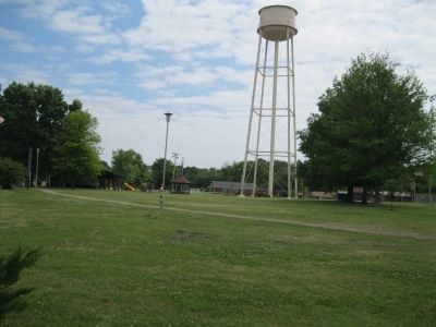
Location. 35° 13.899′ N, 88° 22.947′ W. Marker is in Adamsville, Tennessee, in McNairy County. Marker is at the intersection of Walnut Street and Pusser Street, on the right when traveling north on Walnut Street. Touch for map. Marker is in this post office area: Adamsville TN 38310, United States of America. Touch for directions.
Other nearby markers. At least 8 other markers are within 6 miles of this marker, measured as the crow flies. Approach to Shiloh (approx. 0.3 miles away); Adamsville In The Civil War (approx. ¾ mile away); a different marker also named Approach to Shiloh (approx. 1.3 miles away); a different marker also named Approach to Shiloh (approx. 1.3 miles away); October 4th 1969 (approx. 1.8 miles away); Buford Hayse Pusser (approx. 4.7 miles away); Memorial to Veterans (approx. 5.7 miles away); Whittlesey's Brigade (approx. 5.8 miles away). Touch for a list and map of all markers in Adamsville.
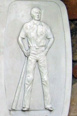
More about this marker. On the right panel is an engraving of Buford Pusser holding a wooden club.
Credits. This page was last revised on August 11, 2023. It was originally submitted on June 26, 2012, by David Graff of Halifax, Nova Scotia. This page has been viewed 1,792 times since then and 122 times this year. Photos: 1, 2, 3, 4. submitted on June 26, 2012, by David Graff of Halifax, Nova Scotia. • Bernard Fisher was the editor who published this page.


