
Highlands in Monmouth County, New Jersey — The American Northeast (Mid-Atlantic)
Highlands Doughboy World War I Monument
Photographed by R. C.
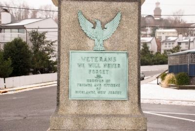
1. Front Plaque on Doughboy Monument
We Will Never
Forget
Erected by
Friends and Citizens
of
Highlands, New Jersey
Erected by Citizens of Highlands, New Jersey.
Topics. This historical marker and monument is listed in this topic list: War, World I.
Location. 40° 23.807′ N, 73° 58.95′ W. Marker is in Highlands, New Jersey, in Monmouth County. It is at the intersection of Portland Rd and Highland Ave, on the right when traveling north on Portland Rd. Monument is adjacent to State Route 36 and is immediately before the bridge on the Highlands side of Sandy Hook Bay. Touch for map. Marker is at or near this postal address: 1 State Route 36, Highlands NJ 07732, United States of America. Touch for directions.

Regionally, this marker and monument is in New Jersey’s Central Jersey, specifically on the Jersey Shore, and in the New York City Metropolitan Area. It is also in the American Northeast, in the Mid-Atlantic, and on the Eastern Seaboard. Globally, it is in the North Atlantic Region, North America, the Western Hemisphere, the Western World, and the Anglosphere. Historically,
this page online
Other nearby markers. At least 8 other markers are within walking distance of this marker: From the Navesink Highlands (approx. 0.2 miles away); Twin Lights Mystery Cannon (approx. 0.2 miles away); Electric Power Station (approx. 0.2 miles away); Telegraph and Radar at Twin Lights (approx. 0.2 miles away); Powerhouse (approx. 0.2 miles away); The Navesink Light Station (approx. 0.2 miles away); a different marker also named Navesink Light Station (approx. 0.2 miles away); a different marker also named The Old North Tower (approx. 0.2 miles away). Touch for a list and map of all markers in Highlands.
Other markers no longer nearby. Powerhouse (was approx. 0.2 miles away but has been replaced with another marker now near it); a different marker also named Telegraph and Radar at Twin Lights (was approx. 0.2 miles away but has been replaced with another marker now near it); The Old North Tower (was approx. 0.2 miles away but has been replaced with another marker now near it).
Photographed by R. C.
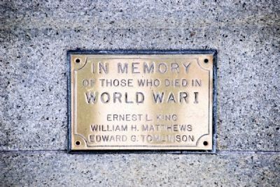
2. Smaller Plaque on Monument Front
Of Those Who Died in
World War I
Ernest L. King
William H. Matthews
Edward G. Tomlinson
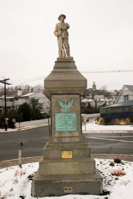
Photographed by R. C.
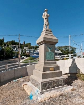
3. Front of Monument
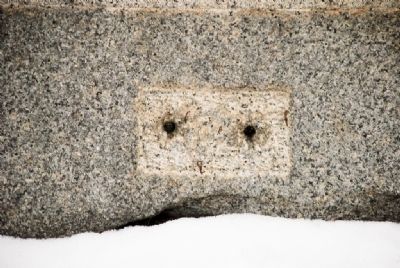
Missing plaque can be seen at bottom of marker. Due to the small footprint of the plaque, it likely named the sculptor, or perhaps a rededication date of the monument.
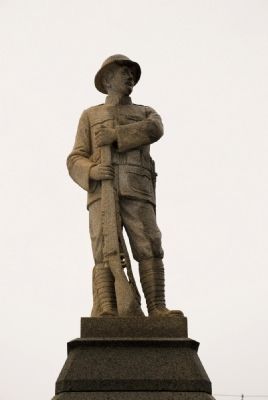
Photographed by R. C.
4. Doughboy (front)
Photographed by R. C.
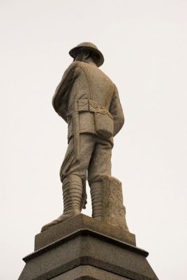
5. Doughboy (rear)
Photographed by R. C.
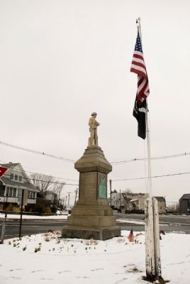
6. View of Monument from Intersection
Photographed by R. C.
7. Footprint of Missing Small Plaque
Photographed by R. C., October 17, 2010
8. Highlands Doughboy World War I Monument
The State of New Jersey recently tore down the old drawbridge that spanned the Shrewsbury River and replaced it with an artistically uninspired modern bridge that allows taller ships to pass under it. Unfortunately for the poor doughboy, his view of the sea has been blocked by an on-ramp.
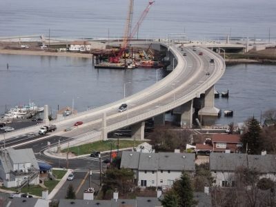
Photographed by Bill Coughlin, April 14, 2011
9. Doughboy Monument
The Doughboy statue is seen here next to the new bridge. Statue can be seen at the bottom left of the photo.
Credits. This page was last revised on June 16, 2016. It was originally submitted on February 24, 2008, by Ronald Claiborne of College Station, Texas. This page has been viewed 1,605 times since then and 43 times this year. Photos: 1, 2, 3, 4, 5, 6, 7. submitted on February 24, 2008, by Ronald Claiborne of College Station, Texas. 8. submitted on October 12, 2010, by Ronald Claiborne of College Station, Texas. 9. submitted on April 19, 2011, by Bill Coughlin of Woodland Park, New Jersey. • Kevin W. was the editor who published this page.
