Edenton Mill Village
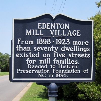
From 1898-1923 more than seventy dwellings existed on five streets for mill families.
Deeded to the Historic Preservation Foundation of NC in 1995.
Topics. This historical marker is listed in this topic list: Industry & Commerce. A significant historical year for this entry is 1995.
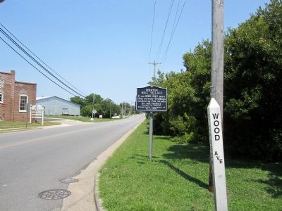
Location. 36° 3.59′ N, 76° 36.152′ W. Marker is in Edenton, North Carolina, in Chowan County. It is at the intersection of East Church Street (State Highway 32) and Wood Avenue, on the right when traveling east on East Church Street. Touch for map. Marker is in this post office area: Edenton NC 27932, United States of America. Touch for directions.
Regionally, this marker is in North Carolina’s Coastal Plain. It is also in the American South, specifically in the Upper South, in the Tidewater, and on the Eastern Seaboard. Globally, it is in the North Atlantic Region, North America, the Western Hemisphere, the Western World, and the Anglosphere. Historically, it finds itself in what was once the territory of the Mississippian Culture, one of the original Thirteen Colonies, one of the Confederate States of America, and the Antebellum
this page online
Other nearby markers. At least 8 other markers are within walking distance of this marker: Edenton Cotton Mill (about 500 feet away, measured in a direct line); St. John's Episcopal School / Church of St. John the Evangelist (approx. 0.2 miles away); The Edenton Academy (approx. ¼ mile away); 1897 Kadesh A.M.E. Zion Church (approx. ¼ mile away); Thomas C. Manning (approx. ¼ mile away); Chowan County Veterans Memorial (approx. ¼ mile away); Chowan County Ultimate Sacrifice Memorial (approx. ¼ mile away); Residence of James Iredell (approx. ¼ mile away). Touch for a list and map of all markers in Edenton.
Credits. This page was last revised on June 24, 2021. It was originally submitted on July 2, 2012, by Bernard Fisher of Richmond, Virginia. This page has been viewed 594 times since then and 23 times this year. Photos: 1, 2. submitted on July 2, 2012, by Bernard Fisher of Richmond, Virginia.
