Davis in Yolo County, California — The American West (Pacific Coastal)
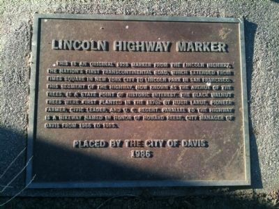
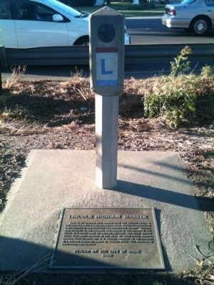
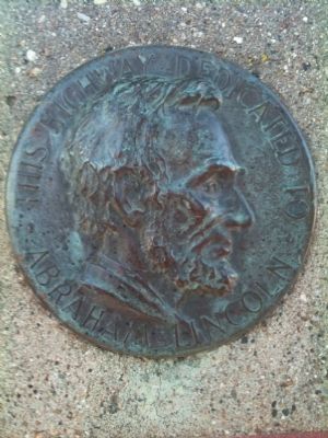
Lincoln Highway Marker
Erected 1986 by The City of Davis.
Topics and series. This historical marker is listed in this topic list: Roads & Vehicles. In addition, it is included in the Lincoln Highway series list. A significant historical year for this entry is 1928.
Location. 38° 32.81′ N, 121° 46.24′ W. Marker is in Davis, California, in Yolo County. Marker can be reached from the intersection of Russell Boulevard and Arthur Street, on the left when traveling west. Touch for map. Marker is in this post office area: Davis CA 95616, United States of America. Touch for directions.
Other nearby markers. At least 8 other markers are within 2 miles of this marker, measured as the crow flies. Solano House (approx. 1.3 miles away); Old Davis High School (approx. 1.3 miles away); Site of the Jerome C. and Mary Chiles Davis Homestead (approx. 1.3 miles away); Lake Spafford (approx. 1.4 miles away); a different marker also named Lincoln Highway Marker (approx. 1.4 miles away); Davis Library Building (approx. 1.4 miles away); First Bicycle Lanes in Davis (approx. 1.4 miles away); The Bentley House (approx. 1.6 miles away). Touch for a list and map of all markers in Davis.
More about this marker. Davis has two Lincoln Highway Markers. This one is in West Davis.
Regarding Lincoln Highway Marker. Along with George Pierce, Jr.—another son of a pioneer farmer—Hugh LaRue's son Jacob lobbied hard on behalf of the University Farm, which became U.C. Davis. Jacob died at the age of 47 just before he could see his labors bear fruit.
The LaRue's family farm was known as Arlington Farm and the farm house still stands at 2727 Russell Boulevard.
Credits. This page was last revised on June 16, 2016. It was originally submitted on July 3, 2012, by Adrian Gabriel of Davis, California. This page has been viewed 685 times since then and 22 times this year. Photos: 1, 2, 3, 4. submitted on July 3, 2012, by Adrian Gabriel of Davis, California. • Syd Whittle was the editor who published this page.


