Enka Village in Buncombe County, North Carolina — The American South (South Atlantic)
William Moore
Photographed by Mike Stroud, May 19, 2012
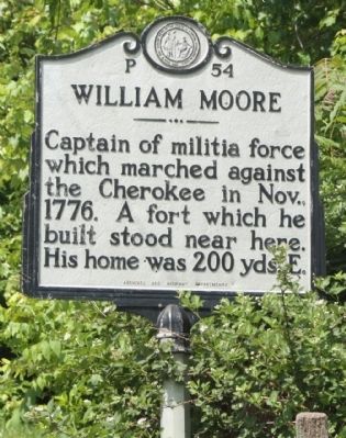
1. William Moore Marker
Captain of militia force which marched against the Cherokee in Nov., 1776. A fort which he built stood near here. His home was 200 yds. E.
Erected 1960 by Archives and Highway Departments. (Marker Number P-54.)
Topics and series. This historical marker is listed in this topic list: Wars, US Indian. In addition, it is included in the North Carolina Division of Archives and History series list. A significant historical year for this entry is 1776.
Location. 35° 32.796′ N, 82° 38.025′ W. Marker is in Enka Village, North Carolina, in Buncombe County. It is on Sand Hill Road (Route 3412), on the left when traveling south. Touch for map. Marker is in this post office area: Asheville NC 28806, United States of America. Touch for directions.

Regionally, this marker is in the Mountains and in Greater Asheville. It is also in the American South, specifically in the Upper South, in Appalachia, and specifically in Southern Appalachia. Globally, it is in North America, the Western Hemisphere, the Western World, and the Anglosphere. Historically, it finds itself in what was once the original Cherokee Nation, the territory
this page online
Other nearby markers. At least 8 other markers are within 4 miles of this marker, measured as the crow flies: Home Place of Capt. Wm. Moore (about 300 feet away, measured in a direct line); Sulphur Springs (approx. 1.9 miles away); Rutherford Trace (approx. 2 miles away); a different marker also named Rutherford Trace (approx. 2 miles away); Olive Tilford Dargan (approx. 3 miles away); "End of Car Line" (approx. 3.2 miles away); Dr. L.B. McBrayer (approx. 3.4 miles away); The Quilt Garden (approx. 3.7 miles away).
More about this marker. House is not visible from the roadway
Regarding William Moore. William Moore was born in Ireland and became one of the first white settlers west of the Blue Ridge in what is known as Buncombe County. Moore’s first visit to the area came in the fall of 1776 when he served as a militia captain under the command of General Griffith Rutherford. Rutherford’s expedition into western sections of North Carolina was designed to stop conflicts between the native
Photographed by Mike Stroud, May 19, 2012
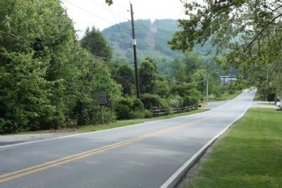
2. William Moore Marker, seen looking southbound, on Sand Hill Road (Route 3412)
Moore wrote a detailed account of an expedition of mounted troops that he led through the region. In his account, Moore described destruction of Indian towns and villages plus the brutal murder and mutilation of natives who were fleeing his men. Moore was at odds with his men over the care of Indian prisoners. Upon threat of mutiny, Moore was reluctantly obliged to sell some of their prisoners into slavery and divide the bounty among his men.
Moore returned to western North Carolina after Rutherford’s expedition and settled on land along Hominy Creek. Moore and second wife, Margaret Patton, raised his six children from his first marriage to Ann Cathey as well as their six children. Moore served during the Revolution and then returned to Buncombe to serve in municipal and civic roles the remainder of his life. It is said that Moore first constructed a block fort on his property near Hominy Creek for protection
Photographed by Mike Stroud, May 19, 2012
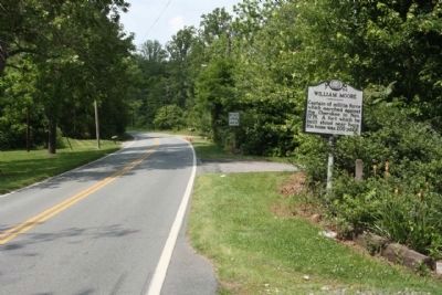
3. William Moore Marker, looking north along Sand Hill Road
Also see . . . The Rutherford Expedition. NCpedia website entry (Submitted on October 31, 2024, by Larry Gertner of New York, New York.)
Credits. This page was last revised on January 2, 2025. It was originally submitted on July 5, 2012, by Mike Stroud of Bluffton, South Carolina. This page has been viewed 1,749 times since then and 125 times this year. Photos: 1, 2, 3. submitted on July 5, 2012, by Mike Stroud of Bluffton, South Carolina.
