Eastman in Dodge County, Georgia — The American South (South Atlantic)
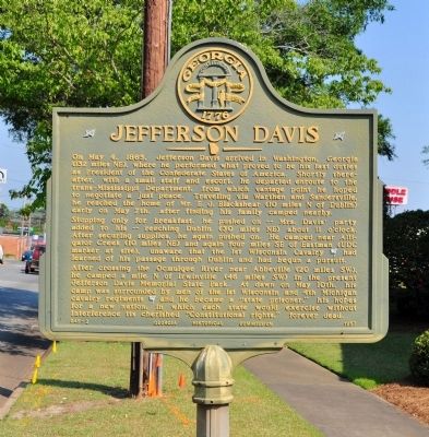
Jefferson Davis
Stopping only for breakfast he pushed on -- Mrs. Davis’ party added to his -- reaching Dublin (30 miles NE) about 11 o’clock. After securing supplies, he again pushed on. He camped near Alligator Creek (10 miles NE) and again four miles SE of Eastman (UDC marker at site), unaware that the 1st Wisconsin Cavalry [US] had learned of his passage through Dublin and had begun a pursuit.
After crossing the Ocmulgee River near Abbeville (20 miles SW), he camped a mile N of Irwinville (46 miles SW) in the present Jefferson Davis Memorial State Park. At dawn on May 10th, his camp was surrounded by men of the 1st Wisconsin and 4th Michigan cavalry regiments [US] and he became a “state prisoner,” his hopes for a new nation, in which each state would exercise without interference its cherished “Constitutional Rights,” forever dead.
Erected 1957 by Georgia Historical Commission. (Marker Number 045-2.)
Topics and series. This historical marker is listed in this topic list: War, US Civil. In addition, it is included in the Georgia Historical Society series list. A significant historical month for this entry is May 1992.
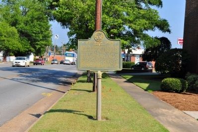
Location. 32° 11.911′ N, 83° 10.781′ W. Marker is in Eastman, Georgia, in Dodge County. Marker is at the intersection of Oak Street (U.S. 23) and Sixth Avenue, on the right when traveling east on Oak Street. The marker stands at the First Baptist Church in Eastman. Touch for map. Marker is at or near this postal address: 5107 Oak Street, Eastman GA 31023, United States of America. Touch for directions.
Other nearby markers. At least 8 other markers are within 11 miles of this marker, measured as the crow flies. The Eastman-Bishop-Bullock House (about 800 feet away, measured in a direct line); Dodge County (approx. ¼ mile away); Dodge County Confederate Monument (approx. 0.3 miles away); The Blackshear Road (approx. half a mile away); Old Eastman School (approx. 0.6 miles away); Stuckey's (approx. 1.2 miles away); Orphans Cemetery (approx. 2.2 miles away); Normandale (approx. 10.2 miles away). Touch for a list and map of all markers in Eastman.
Credits. This page was last revised on June 16, 2016. It was originally submitted on July 5, 2012, by David Seibert of Sandy Springs, Georgia. This page has been viewed 730 times since then and 40 times this year. Photos: 1, 2, 3. submitted on July 5, 2012, by David Seibert of Sandy Springs, Georgia. • Craig Swain was the editor who published this page.


