Fort Meade in Polk County, Florida — The American South (South Atlantic)
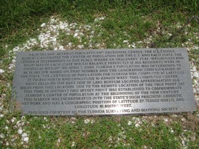
Florida 2000 Center of Population
Erected by the Florida Surveying and Mapping Society.
Topics. This historical marker is listed in this topic list: Notable Places. A significant historical date for this entry is April 1, 2000.
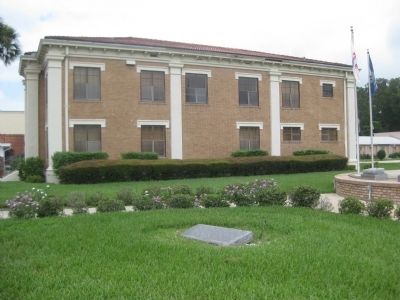
Location. 27° 45.122′ N, 81° 48.107′ W. Marker is in Fort Meade, Florida, in Polk County. Marker is at the intersection of West Broadway Street and Charleston Avenue, on the right when traveling west on West Broadway Street. The marker is located on the grounds of Fort Meade City Hall, in the grassy plaza on the east side of the building. Touch for map. Marker is at or near this postal address: 8 West Broadway Street, Fort Meade FL 33841, United States of America. Touch for directions.
Other nearby markers. At least 8 other markers are within 5 miles of this marker, measured as the crow flies. Fort Meade Veterans Memorial (a few steps from this marker); Christ Church (approx. 0.3 miles away); The W. Henry Lewis House (approx. half a mile away); Site of Fort Meade (approx. half a mile away); Lt. Gen. Thomas J. "Stonewall" Jackson Memorial (approx. half a mile away); Willoughby Tillis Battle Monument (approx. ¾ mile away); Homeland School (approx. 4.9 miles away); Historic Kissengen Spring (approx. 4.9 miles away). Touch for a list and map of all markers in Fort Meade.
More about this marker. The marker is a rectangular slab of polished granite laying flat on the ground, facing up. Following the plane of the marker text, the geodetic disk is found just below it.
It should be noted that the geographic coordinates stated near the bottom of the historical marker pertain to the geodetic marker/survey disk, not the historical marker. The coordinates referenced above in "Location" pertain to the
historical marker itself, and as such differ slightly from the disk's coordinates.
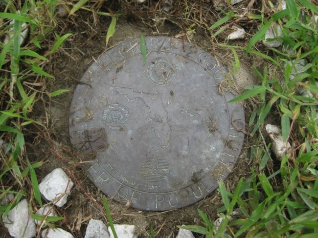
Regarding Florida 2000 Center of Population. The geodetic disk reads (circular):
Center of Population
The interior portion of the disc contains emblems of the American Congress on Surveying and Mapping, the National Geodetic Survey, and the FSMS (Florida Surveying and Mapping Society), as well as a fourth emblem which is unidentified. At the center is a diagram of Florida showing Polk County, inside of which lies a point mapping the location of the Center of Population. Along the bottom of the interior disk area is stated the following: Disk sponsored by Pickett & Associates, Inc.
Credits. This page was last revised on June 16, 2016. It was originally submitted on July 7, 2012, by Glenn Sheffield of Tampa, Florida. This page has been viewed 631 times since then and 27 times this year. Photos: 1, 2, 3. submitted on July 7, 2012, by Glenn Sheffield of Tampa, Florida. • Craig Swain was the editor who published this page.


