Manitowoc in Manitowoc County, Wisconsin — The American Midwest (Great Lakes)
Potter's Field Cemetery
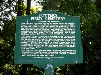
Photographed by Kent Salomon, July 8, 2012
1. Potter's Field Cemetery Marker
The name "Potter's Field" is of Biblical origin. After Judas Iscariot returned the 30 pieces of silver he had recieved for betraying Jesus Christ, the high priests of Jerusalem would not deposit it in the temple treasury since it was blood money. Instead, they bought a potter's clay field as a cemetery for foreigners. The term was widely used in the United States during the 19th and early 20th centuries for public burial grounds of unknown persons, criminals and the poor.
The Potter's Field grounds were improved and headstones restored by a Beautification Committee of local concerned citizens in 1995. The large granite Memorial Marker was dedicated on May 20, 1996.
Erected 1996
this page online
Topics. This historical marker is listed in these topic lists: Cemeteries & Burial Sites • Charity & Public Work. A significant historical month for this entry is May 1668.
Location. 44° 5.723′ N, 87° 41.654′ W. Marker is in Manitowoc, Wisconsin, in Manitowoc County. It is on Meadow Lane west of Broadway Street, on the left when traveling west. Touch for map. Marker is at or near this postal address: 3831 Meadow Ln, Manitowoc WI 54220, United States of America. Touch for directions.

Regionally, this marker is on the Door Peninsula. It is also in the American Midwest and in the Corn Belt. Globally, it is in North America, on the Great Lakes, in the Western Hemisphere, in the Western World, and in the Anglosphere. Historically, it finds itself in what was once the territory of the Mississippian Culture and also the Northwest Territory.
Other nearby markers. At least 8 other markers are within 2 miles of this marker, measured as the crow flies: County Hospital Cemetery (within shouting distance of this marker); Old Military Road (approx. 0.4 miles away); First Court House and Jail (approx.
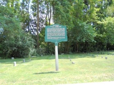
Photographed by Kent Salomon, July 8, 2012
2. Potter's Field Cemetery Marker
Credits. This page was last revised on June 16, 2016. It was originally submitted on July 8, 2012, by Kent Salomon of Manitowoc,, Wisconsin. This page has been viewed 1,503 times since then and 80 times this year. Photos: 1, 2. submitted on July 8, 2012, by Kent Salomon of Manitowoc,, Wisconsin. • Bernard Fisher was the editor who published this page.
