Ponte Vedra Beach in St. Johns County, Florida — The American South (South Atlantic)
World War II Operation Pastorius
⎯⎯⎯
St. Johns County
Nazi Saboteurs Landed Here
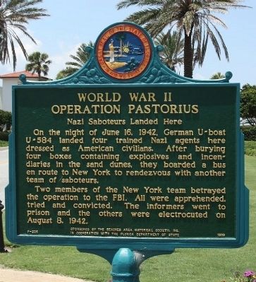
Photographed by Mike Stroud, July 10, 2012
1. World War II Operation Pastorius Marker
World War II Operation Pastorius
Nazi Saboteurs Landed Here
On the night of June 16, 1942, German U-boat U-584 landed four trained Nazi agents here dressed as American civilians. After burying four boxes containing explosives and incendiaries in the sand, they boarded a bus en route to New York to rendezvous with another team of saboteurs.
Two members of the New York team betrayed the operation to the FBI. All were apprehended, tried and convicted. The informers went to prison and the others were electrocuted on August 8, 1942.
St. Johns County
On July 21, 1821, Major General Jackson, Florida's first Territorial Governor, established St. Johns County, with St. Augustine as the county seat. It contained all of Florida east of the Suwannee River, approximately 39,400 square miles, with over 1,100 miles of coastline. Since 1821, more than ⅔ of Florida's present 67 counties have been carved from St. Johns County's original boundaries reducing our County to 609 square miles.
Erected 1989 by The Beaches Area Historical Society, Inc. in Cooperation With The Florida Department of State. (Marker Number F-326.)
Topics.
this page online
Location. 30° 14.529′ N, 81° 22.72′ W. Marker is in Ponte Vedra Beach, Florida, in St. Johns County. It is on Ponte Vedra Blvd. (State Road 203), on the right when traveling north. located in front of Ponte Vedra Inn & Club. Touch for map. Marker is at or near this postal address: 200 Ponte Vedra Blvd, Ponte Vedra Beach FL 32082, United States of America. Touch for directions.

Regionally, this marker is in First Coast and in Greater Jacksonville. It is also in the American South and on the Eastern Seaboard. Globally, it is in the North Atlantic Region, North America, a Gulf of Mexico state, the Western Hemisphere, the Western World, and the Anglosphere. Historically, it finds itself in what was once New Spain, the territory of the Mississippian Culture, one of the Confederate States of America, and the Antebellum South.
Other nearby markers. At least 8 other markers are within 4 miles of this marker, measured as the crow flies: Coastal Weather (approx. 2.9 miles away); World War II Veterans Memorial (approx.
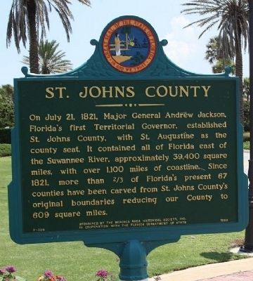
Photographed by Mike Stroud, July 10, 2012
2. St. Johns County Marker
Another marker is no longer nearby. Mayport Depot (was approx. 3.3 miles away but has been replaced with another marker now near it).
Also see . . .
1. About uboat.net; German saboteur landings in June 1942. Shortly after he declared war on the United States on Dec 11, 1941 Adolf Hitler wanted to show Americans that they were not safe inside their borders even so far from the battlefields of Europe. He ordered a sabotage operation against targets inside America and Abwehr, the defence intelligence unit, got the job. (Submitted on July 11, 2012, by Mike Stroud of Bluffton, South Carolina.)
2. Operation Pastorius. Their mission was to stage sabotage attacks on American economic targets: hydroelectric plants at Niagara Falls; the Aluminum Company of America's
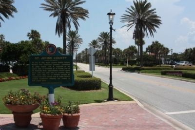
Photographed by Mike Stroud, July 10, 2012
3. St. Johns County Marker side
Looking south along Ponte Vedra Blvd.
Additional commentary.
1. - Fate of the German U-boat U-584
... Sunk 31 Oct, 1943 in the North Atlantic, in position 49.14N, 31.55W, by a Fido homing torpedo from 3 Avenger aircraft (VC-9) of the US escort carrier USS Card. 53 dead (all hands lost).
— Submitted July 12, 2012, by Mike Stroud of Bluffton, South Carolina.
2. - German U-boat U-202
...The boat left Brest, France on a very special patrol on 27 May 1942. On 12 June, after crossing the Atlantic submerged by day and surfaced by night, they landed a saboteur team of 4 men
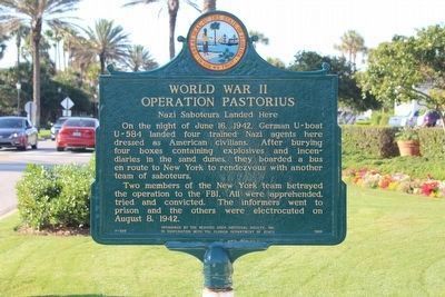
Photographed by Tim Fillmon, April 8, 2016
4. Newly restored Operation Pastorius side of marker
Fate of the U-202 Sunk at 0030 hrs on 2 June, 1943 south-east of Cape Farewell, Greenland, in position 56.12N, 39.52W, by depth charges and gunfire from the British sloop HMS Starling. 18 dead and 30 survivors.
— Submitted July 12, 2012, by Mike Stroud of Bluffton, South Carolina.
Additional keywords. Spies,sabotage
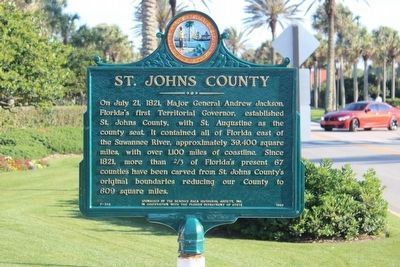
Photographed by Tim Fillmon, April 8, 2016
5. Newly restored St. Johns County side of marker
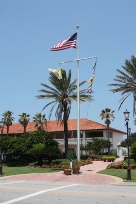
Photographed by Mike Stroud, July 10, 2012
6. Operation Pastorius Marker
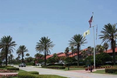
Photographed by Mike Stroud, July 10, 2012
7. Operation Pastorius Marker
Looking north on Ponte Vedra Boulevard. The Ponte Vedra Inn & Club beachside villas can be seen in this view.
Credits. This page was last revised on June 18, 2025. It was originally submitted on July 11, 2012, by Mike Stroud of Bluffton, South Carolina. This page has been viewed 2,468 times since then and 200 times this year. Photos: 1, 2, 3. submitted on July 11, 2012, by Mike Stroud of Bluffton, South Carolina. 4, 5. submitted on April 8, 2016, by Tim Fillmon of Webster, Florida. 6, 7. submitted on July 11, 2012, by Mike Stroud of Bluffton, South Carolina.
