Chenault Road in Lexington in Fayette County, Kentucky — The American South (East South Central)
Ashland Park
⎯⎯⎯
Olmsted Brothers In KY
Photographed by Ken Smith, July 11, 2012
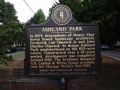
1. Ashland Park Marker
Ashland Park. In 1904, descendants of Henry Clay hired famed landscape architects, Frederick Law Olmsted Jr. and John Charles Olmsted, to design Ashland Park neighborhood on the 600-acre estate. Constructed over a 15-year period, development was completed around 1930. The brothers designed U.S. Capitol & White House grounds, and the Chicago World's Fair 1893.
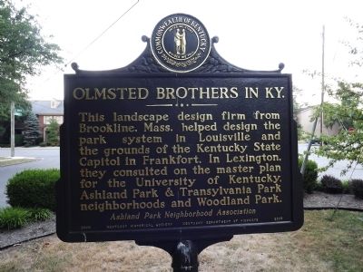
Olmstead Brothers in Ky. This landscape design firm from Brookline, Mass. helped design the park system in Louisville and the grounds of the Kentucky State Capitol in Frankfort. In Lexington, they consulted on the master plan for the University of Kentucky, Ashland Park & Transylvania Park neighborhoods and Woodland Park.
Erected 2009 by Kentucky Historical Society & Kentucky Department of Highways; Ashland Park Neighborhood Association. (Marker Number 2305.)
Topics and series. This historical marker is listed in this topic list: Settlements & Settlers. In addition, it is included in the Kentucky Historical Society series list. A significant historical year for this entry is 1904.
Location. 38° 2.038′ N, 84° 29.017′ W. Marker is in Lexington, Kentucky, in Fayette
this page online

Regionally, this marker is in the Bluegrass Region. It is also in the American South and specifically in the Upper South. Globally, it is in North America, the Western Hemisphere, the Western World, and the Anglosphere. Historically, it finds itself in what was once the territory of the Mississippian Culture and also the Antebellum South.
Other nearby markers. At least 8 other markers are within walking distance of this marker: Mentelle Park / Mentelle School (about 500 feet away, measured in a direct line); Henry Clay (approx. 0.4 miles away); "Ashland" (approx. 0.4 miles away); Agriculture at Ashland (approx. 0.4 miles away); Bell Place (approx. 0.4 miles away); Madeline M. Breckinridge / Kentucky Suffrage Leader (approx. 0.4 miles away); Abraham Lincoln and Henry Clay (approx. 0.4 miles away); Ashland / Clay & Abraham Lincoln
Photographed by Ken Smith, July 11, 2012
2. Olmsted Brothers In KY Marker
Also see . . . Ashland Park. Historic early 20th century neighborhood in Lexington, Kentucky. (Submitted on July 15, 2012, by Ken Smith of Milan, Tennessee.)
Photographed by Ken Smith, July 11, 2012
3. Ashland Park / Olmsted Brothers In KY Marker
Photographed by Ken Smith, July 11, 2012
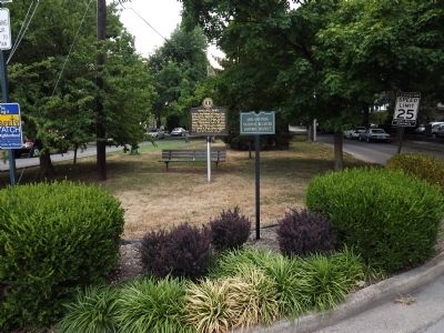
4. Ashland Park Marker
Credits. This page was last revised on August 28, 2023. It was originally submitted on July 15, 2012, by Ken Smith of Milan, Tennessee. This page has been viewed 1,502 times since then and 55 times this year. Photos: 1, 2, 3, 4. submitted on July 15, 2012, by Ken Smith of Milan, Tennessee. • Bernard Fisher was the editor who published this page.
