
Calhoun in Gordon County, Georgia — The American South (South Atlantic)
Lay’s Ferry
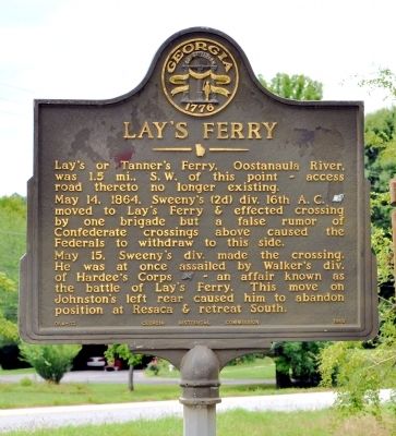
Photographed by David Seibert, July 15, 2012
1. Lay’s Ferry Marker
Lay’s or Tanner’s Ferry, Oostanaula River, was 1.5 mi., S. W. of this point ~ access road thereto no longer existing.
May 14, 1864, Sweeny’s (2d) div. 16th A. C. [US] moved to Lay’s Ferry & effected crossing by one brigade but a false rumor of Confederate crossings above caused the Federals to withdraw to this side.
May 15, Sweeny’s div. made the crossing. He was at once assailed by Walker’s div. of Hardee’s Corps [CS] ~ an affair known as the battle of Lay’s Ferry. This move on Johnston’s left rear caused him to abandon position at Resaca & retreat South.
Erected 1960 by Georgia Historical Commission. (Marker Number 064-12.)
Topics and series. This historical marker is listed in this topic list: War, US Civil. In addition, it is included in the Georgia Historical Society series list. A significant historical month for this entry is May 1782.
Location. 34° 32.062′ N, 84° 58.58′ W. Marker is in Calhoun, Georgia, in Gordon County. It is at the intersection of Georgia Route 136 Connector Road and Hall Memorial Road, on the right when traveling west on Georgia Route 136. Touch for map. Marker is in this post office area:
this page online

Regionally, this marker is in Georgia’s Mountains. It is also in the American South, specifically in the Deep South, in Appalachia, and specifically in Southern Appalachia. Globally, it is in North America, the Western Hemisphere, the Western World, and the Anglosphere. Historically, it finds itself in what was once the original Cherokee Nation, the territory of the Mississippian Culture, one of the original Thirteen Colonies, one of the Confederate States of America, and the Antebellum South.
Other nearby markers. At least 8 other markers are within 3 miles of this marker, measured as the crow flies: Battle of Lay's Ferry (approx. 1½ miles away); Calhoun War Memorial (approx. 2.3 miles away); Sequoyah (approx. 2.3 miles away); Roland Hayes (approx. 2½ miles away); Battle of Resaca (approx. 2½ miles away); Calhoun, Ga, May 18, 1864. (approx. 2.6 miles away); Calhoun Depot (approx. 2.6 miles away); a different marker also named The Calhoun Depot (approx. 2.6 miles away). Touch for a list and map of all markers in Calhoun.
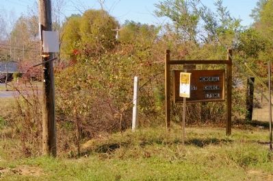
Photographed by David Seibert, November 18, 2008
2. Lay’s Ferry Marker Post
The marker had been missing for many years (here in 2008), and has only been recently reinstalled.
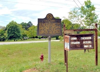
Photographed by David Seibert, July 15, 2012
3. Lay’s Ferry Marker
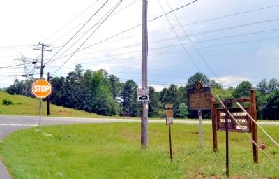
Photographed by David Seibert, July 12, 2012
4. Lay’s Ferry Marker
Lookng southwest toward the old route (no longer existing) to Lay's Ferry.
Credits. This page was last revised on November 25, 2020. It was originally submitted on July 16, 2012, by David Seibert of Sandy Springs, Georgia. This page has been viewed 1,334 times since then and 42 times this year. Photos: 1, 2, 3, 4. submitted on July 16, 2012, by David Seibert of Sandy Springs, Georgia. • Craig Swain was the editor who published this page.
