Lower South Providence in Providence County, Rhode Island — The American Northeast (New England)
Prince Hall
Photographed by Bryan Simmons, July 2012
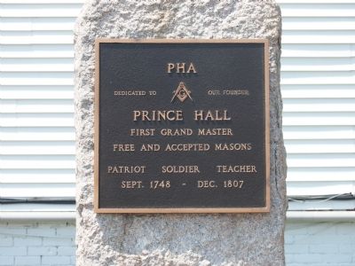
1. Prince Hall Marker
Dedicated To Our Founder
Prince Hall
First Grand Master
Free and Accepted Masons
Patriot Soldier Teacher
Sept. 1748 - Dec. 1807
Topics. This historical marker is listed in these topic lists: African Americans • Fraternal or Sororal Organizations. A significant historical month for this entry is September 1748.
Location. 41° 48.223′ N, 71° 24.417′ W. Marker is in Providence, Rhode Island, in Providence County. It is in Lower South Providence. It is at the intersection of Eddy Street and Mutual Street, on the right when traveling south on Eddy Street. Touch for map. Marker is in this post office area: Providence RI 02907, United States of America. Touch for directions.

Regionally, this marker is on Rhode Island’s Narragansett Bay. It is also in the American Northeast, in New England, and on the Eastern Seaboard. Globally, it is in the North Atlantic Region, North America, the Western Hemisphere, the Western World, and the Anglosphere. Historically, it finds itself in what was once one of the original Thirteen Colonies.
Other nearby markers. At least 8 other markers are within walking distance
this page online
Photographed by Bryan Simmons, July 2012
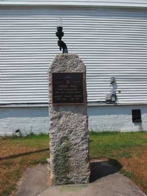
2. Prince Hall Marker
Credits. This page was last revised on February 8, 2023. It was originally submitted on July 16, 2012, by Bryan Simmons of Attleboro, Massachusetts. This page has been viewed 685 times since then and 20 times this year. Photos: 1, 2. submitted on July 16, 2012, by Bryan Simmons of Attleboro, Massachusetts. • Bill Pfingsten was the editor who published this page.
