Near Browns Valley in Yuba County, California — The American West (Pacific Coastal)
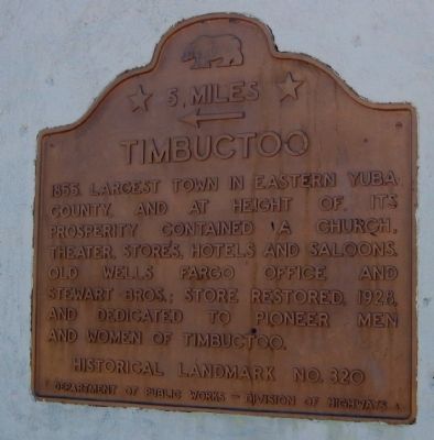
Timbuctoo
← 5 Miles
Erected by Department of Public Works – Division of Highways. (Marker Number 320.)
Topics and series. This historical marker is listed in these topic lists: Industry & Commerce • Natural Resources • Notable Places • Settlements & Settlers. In addition, it is included in the California Historical Landmarks series list. A significant historical year for this entry is 1855.
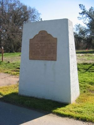
Location. Marker has been reported permanently removed. It was located near 39° 13.76′ N, 121° 22.969′ W. Marker was near Browns Valley, California, in Yuba County. Marker was on California Route 20, 0.2 miles east of Monument Trail, on the right when traveling east. Touch for map. Marker was in this post office area: Browns Valley CA 95918, United States of America.
We have been informed that this sign or monument is no longer there and will not be replaced. This page is an archival view of what was.
Other nearby markers. At least 8 other markers are within 5 miles of this location, measured as the crow flies. Hammon Grove (approx. 0.9 miles away); Browns Valley: 1850 – 1860 (approx. 1.6 miles away); Brown's Valley: Beginnings (approx. 1.6 miles away); Donnebrouge Mine (approx. 1.7 miles away); The Yuba River Bridge at Parks Bar (approx. 2.7 miles away); Sucker Flat (approx. 4.6 miles away); Smartville / Smartsville (approx. 4.8 miles away); Smartsville Grocery (approx. 4.8 miles away). Touch for a list and map of all markers in Browns Valley.
Also see . . .
1. Ghost Towns: Timbuctoo. (Submitted on December 5, 2008.)
2. Timbuctoo, California. A new website dedicated to exploring the rich history of Timbuctoo, California. (Submitted on February 19, 2018, by Lane Parker of San Francisco, California.)
Additional commentary.
1. The other marker
Until at least 1947, there was a 1˝ mile marker to the east of Timbuctoo on Highway 20. That marker was identical to the 5 mile marker shown.
[A new marker was installed in 2022. -ed] Note To Editor only visible by Contributor and editor
— Submitted December 8, 2008, by Lane Parker of San Francisco, California.
2. Marker inscription
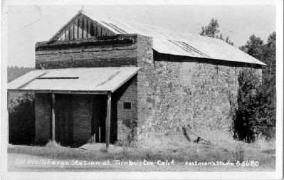
Although the State historic marker reads "store restored, 1928..." the commemorative plaque placed on the Wells Fargo and Stewart Bros. store building by the Native Daughters of the Golden West (Parlor 162) and Native Sons of the Golden West (Parlor 6) was dated May 10, 1925. (The plaque is visible on the right side of the building's facade in Photo #6.) So, a three-year discrepancy exists between the NDGW/NSGW restoration date and the California Department of Public Works date. Note To Editor only visible by Contributor and editor
— Submitted December 8, 2008, by Lane Parker of San Francisco, California.
3. Landmark Status
Timbuctoo became a California State Registered Historical Landmark (No. 320) on July 12, 1939.
— Submitted December 24, 2008, by Lane Parker of San Francisco, California.
4. Commemorative Plaque
The Commemorative Plaque referenced in Comment #2 reads in full:
"Old Wells Fargo Office & Stewart Bros. Store (1855) Restored and dedicated to the memory of the pioneer men and women of Timbuctoo. May 10, 1925, by Marysville Parlor No. 6, N.S.G.W. Marysville Parlor No. 162, N.D.G.W. Presented by Wells Fargo Bank & Union Trust Co., San Francisco."
Note: The lettering on the plaque is all uppercase.
— Submitted January 6, 2009, by Lane Parker of San Francisco, California.
Wells Fargo Bank Historical Museum
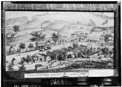
4. Timbuctoo - 1867
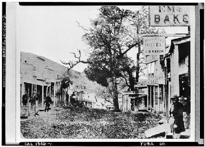
Photocopy of 1867 lithograph (from Wells Fargo Bank Historical Museum, San Francisco, California, 1867) Photographer - George Barrington, Lithograph dated 1862. August 1940 GENERAL VIEW OF MAIN STREET AND ENVIRONS.
Historic American Buildings Survey (Library of Congress)
HABS CAL,58-TIMTO,1-
Historic American Buildings Survey (Library of Congress)
HABS CAL,58-TIMTO,1-
Photographed By James King
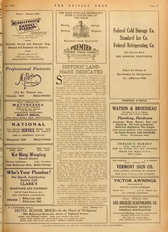
7. Grizzly Bear, June 1926, p33
This is the report of the dedication ceremony for the plaque on the Wells Fargo Building. While the State Parks CHL plaque states the store was restored in 1928, this article from 1926 says that it was restored in 1925.
All indications are that this marker has been lost. If recovered, NSGW/NDGW would like to receive it back for remounting in a roadside monument.
All indications are that this marker has been lost. If recovered, NSGW/NDGW would like to receive it back for remounting in a roadside monument.
Credits. This page was last revised on February 22, 2022. It was originally submitted on December 5, 2008. This page has been viewed 4,336 times since then and 62 times this year. Last updated on August 7, 2020, by Craig Baker of Sylmar, California. Photos: 1. submitted on December 5, 2008, by Syd Whittle of Mesa, Arizona. 2. submitted on August 13, 2016, by Terri Sottile of Oceanside, California. 3. submitted on December 5, 2008, by Syd Whittle of Mesa, Arizona. 4. submitted on April 12, 2009, by Syd Whittle of Mesa, Arizona. 5. submitted on April 9, 2009, by Syd Whittle of Mesa, Arizona. 6. submitted on December 8, 2008, by Syd Whittle of Mesa, Arizona. 7. submitted on February 20, 2018, by James King of San Miguel, California. 8. submitted on December 24, 2008, by Lane Parker of San Francisco, California. • J. Makali Bruton was the editor who published this page.
