Hillhouse Avenue Bridge
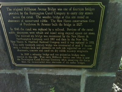
In 1848 the canal was replaced by a railroad. Portions of the canal rubble abutments were rebuilt and raised using stepped square cut stone. The railroad era bridge was maintained by the New Haven & Northampton Company until 1887 and then by the New York, New Haven & Hartford Railroad Company until it was replaced in 1911. This early twentieth century bridge was constructed of steel "T" beams with a wooden deck and sidewalks on each side supported on cut stone abutments, concrete and canal era dry rubble masonry wingwalls.
In 2009 a vehicular bridge and two pedestrian bridges were erected on this site. They carry Hillhouse Avenue over what is now the Farmington Canal Heritage Greenway while preserving the fascia from the reconstructed stone abutments of the earlier bridges.
Topics. This historical marker is listed
this page online
Location. 41° 18.771′ N, 72° 55.429′ W. Marker is in New Haven in South Central Region, Connecticut. It is in Downtown. It is on Hillhouse Avenue when traveling north. Touch for map. Marker is at or near this postal address: 12 Hillhouse Avenue, New Haven CT 06511, United States of America. Touch for directions.

Regionally, this marker is in the Connecticut River Valley and on the Connecticut Shoreline. It is also in the American Northeast, in New England, and on the Eastern Seaboard. Globally, it is in the North Atlantic Region, North America, the Western Hemisphere, the Western World, and the Anglosphere. Historically, it finds itself in what was once New Haven County and also one of the original Thirteen Colonies.
Other nearby markers. At least 8 other markers are within walking distance of this marker: Let Us Pray (about 400 feet away, measured in a direct line); Blessed Is He (about 400 feet away); The Strong Right Arm of the Church (about 400 feet away); The Dominican Legacy (about 400 feet away); Into The Light (about 400 feet away); Two Homes (about 400 feet away); On the Frontline of the Pandemic (about 400 feet away); Turning Friends into Brothers (about 400 feet away). Touch for a list and map of all markers in New Haven.
Additional keywords. Farmington Canal Bridge Railroad New Haven Connecticut
Credits. This page was last revised on May 19, 2026. It was originally submitted on July 20, 2012, by Aaron Goode of New Haven, Connecticut. This page has been viewed 757 times since then and 29 times this year. Photo 1. submitted on July 20, 2012, by Aaron Goode of New Haven, Connecticut. • Bill Pfingsten was the editor who published this page.
