Upper South Providence in Providence County, Rhode Island — The American Northeast (New England)
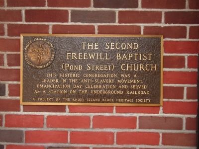
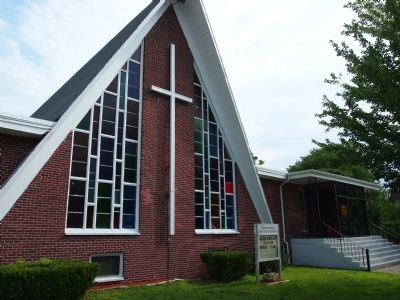
The Second Freewill Baptist (Pond Street) Church
Erected by The Rhode Island Black Heritage Society.
Topics and series. This historical marker is listed in these topic lists: Abolition & Underground RR • African Americans • Churches & Religion. In addition, it is included in the The Rhode Island Black Heritage Society series list.
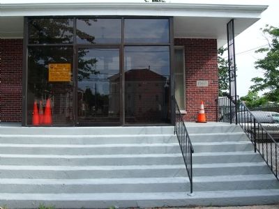
Location. 41° 48.421′ N, 71° 25.013′ W. Marker is in Providence, Rhode Island, in Providence County. It is in Upper South Providence. Marker is at the intersection of Chester Avenue and Mt. Vernon Street, on the left when traveling east on Chester Avenue. Marker is located right inside the doorway. Touch for map. Marker is at or near this postal address: 75 Chester Ave, Providence RI 02907, United States of America. Touch for directions.
Other nearby markers. At least 8 other markers are within walking distance of this marker. United States Marine Corps (approx. half a mile away); Prince Hall Masonic Lodge F.A.M. (approx. 0.6 miles away); Prince Hall (approx. 0.6 miles away); Church of God and Saints of Christ (approx. 0.7 miles away); 220 Lexington Avenue (approx. 0.8 miles away); All Saints' Memorial Church (approx. 0.8 miles away); a different marker also named All Saint's Memorial Church (approx. 0.8 miles away); St. Francis Xavier Convent of Mercy (approx. 0.8 miles away). Touch for a list and map of all markers in Providence.
Credits. This page was last revised on May 7, 2023. It was originally submitted on July 23, 2012, by Bryan Simmons of Attleboro, Massachusetts. This page has been viewed 581 times since then and 9 times this year. Photos: 1, 2, 3. submitted on July 23, 2012, by Bryan Simmons of Attleboro, Massachusetts. • Bill Pfingsten was the editor who published this page.


