Near Bear Valley in Mariposa County, California — The American West (Pacific Coastal)
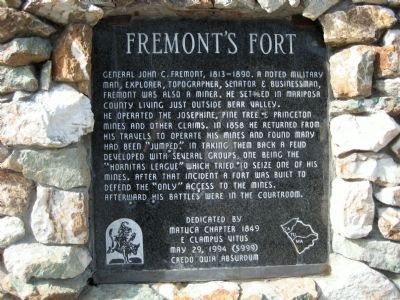
Fremontís Fort
He operated the Josephine, Pine Tree & Princeton mines and other claims. In 1858 he returned from his travels to operate his mines and found many had been “jumped.” In taking them back a feud developed with several groups, one being the “Hornitas League” which tried to seize one of his mines. After that incident a fort was built to defend the “only” access to the mines.
Afterward his battles were in the courtroom.
Erected 1994 by Matuca Chapter 1849 E Clampus Vitus. (Marker Number 5999.)
Topics and series. This historical marker is listed in this topic list: Forts and Castles. In addition, it is included in the E Clampus Vitus series list. A significant historical year for this entry is 1858.
Location. 37° 35.284′ N, 120° 7.468′ W. Marker is near Bear Valley, California, in Mariposa County. Marker is on State Highway 49, on the right when traveling south. The marker is 42.7 miles from downtown Sonora (intersection of North Washington St and Stockton Rd). Touch for map. Marker is in this post office area: Mariposa CA 95338, United States of America. Touch for directions.
Other nearby markers. At least 8 other markers are within 9 miles of this marker, measured as the crow flies. Mrs. E. Trabucco Store (approx. 1.3 miles away); Bear Valley (approx. 1.4 miles away); a different marker also named Bear Valley (approx. 1.4 miles away); Bagby (approx. 1.6 miles away); May Rock (approx. 3.3 miles away); La Mineta 1850 - Princeton 1854 - Mount Bullion 1862 (approx. 7.1 miles away); St. Catherine Catholic Church (approx. 8Ĺ miles away); Cavagnaro General Store (approx. 8.6 miles away). Touch for a list and map of all markers in Bear Valley.
More about this marker. Good turnout and marker is in excellent shape.
Photographed By Richard Wisehart, February 13, 2008
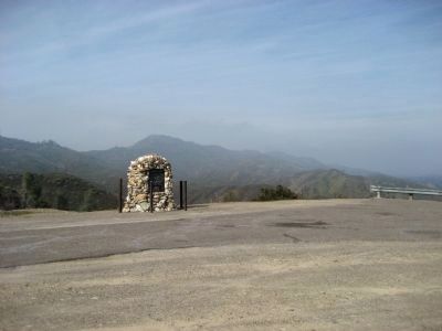
2. Fremont's Fort Marker
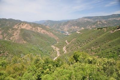
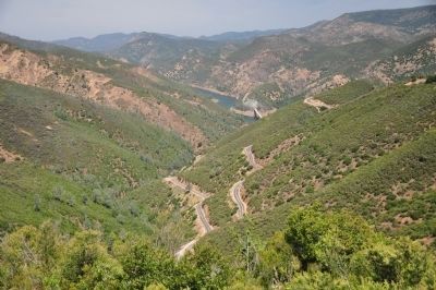
Marker is in distance. View is northerly. Highway 49 is to the right. Bear Valley is approximately 2 miles south. Bagby, on the Merced River, is approximately 2 miles north. The Merced River canyon is in distance behind marker.
Credits. This page was last revised on June 16, 2016. It was originally submitted on February 25, 2008, by Richard Wisehart of Sonora, California. This page has been viewed 3,204 times since then and 118 times this year. Last updated on February 27, 2008, by Richard Wisehart of Sonora, California. Photos: 1, 2. submitted on February 25, 2008, by Richard Wisehart of Sonora, California. 3, 4, 5. submitted on January 13, 2012, by Michael Kindig of Elk Grove, California. • Craig Swain was the editor who published this page.
