Caney in Montgomery County, Kansas — The American Midwest (Upper Plains)
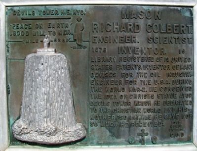
Richard Colbert Mason
Engineer · Scientist · Inventor
Topics. This historical marker is listed in these topic lists: Arts, Letters, Music • Industry & Commerce • Science & Medicine • War, World II.
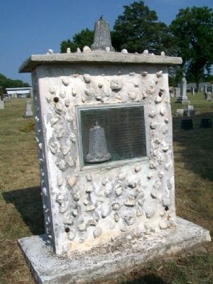
Location. 37° 1.041′ N, 95° 55.771′ W. Marker is in Caney, Kansas, in Montgomery County. Marker is in Sunny Side Cemetery, along the main entrance road about 500 feet north of Taylor Avenue. McGee Street (US Hwy 75) runs along the eastern boundary of the cemetery. Touch for map. Marker is in this post office area: Caney KS 67333, United States of America. Touch for directions.
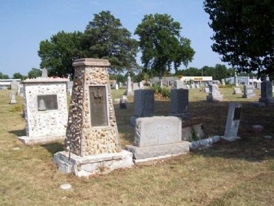
Other nearby markers. At least 8 other markers are within walking distance of this marker. Captain Richard C. Mason (here, next to this marker); Jappa Mason (here, next to this marker); “Walking Stick” Cannon (about 700 feet away, measured in a direct line); Caney War Memorial (about 700 feet away); Black Dog Trail Campsite (approx. 0.4 miles away); George H. Wark 1878 - 1974 (approx. 0.4 miles away); World War Memorial (approx. 0.4 miles away); Bell's Trading Post and Village Water Well (approx. 0.6 miles away). Touch for a list and map of all markers in Caney.
Credits. This page was last revised on November 19, 2019. It was originally submitted on July 27, 2012, by William Fischer, Jr. of Scranton, Pennsylvania. This page has been viewed 576 times since then and 16 times this year. Photos: 1, 2. submitted on July 27, 2012, by William Fischer, Jr. of Scranton, Pennsylvania. 3. submitted on July 26, 2012, by William Fischer, Jr. of Scranton, Pennsylvania.


