Sutter Creek in Amador County, California — The American West (Pacific Coastal)
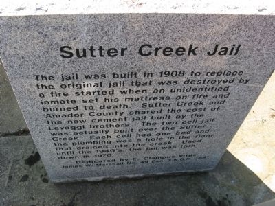
Sutter Creek Jail
Erected 1988 by James W. Marshall Chapter No. 49, E Clampus Vitus, Esq. X.N.G.H. “88”.
Topics and series. This historical marker is listed in this topic list: Government & Politics. In addition, it is included in the E Clampus Vitus series list. A significant historical year for this entry is 1908.
Location. 38° 23.714′ N, 120° 48.178′ W. Marker is in Sutter Creek, California, in Amador County. Marker is on Gopher Flat Road near Main Street/Old Highway 49, on the left when traveling south. Marker is located across the street from the Sutter Creek Post Office. Touch for map. Marker is in this post office area: Sutter Creek CA 95685, United States of America. Touch for directions.
Other nearby markers. At least 8 other markers are within walking distance of this marker. Leland Stanford, Sr. (within shouting distance of this marker); Mahoney Mine (about 300 feet away, measured in a direct line); Wildman Mine (about 300 feet away); C. Soracco Company (about 300 feet away); J. Monteverde General Store Museum (about 400 feet away); 134 Broad Street (about 400 feet away); Sutter Creek Sanitarium (about 400 feet away); Sutter Creek (about 600 feet away). Touch for a list and map of all markers in Sutter Creek.
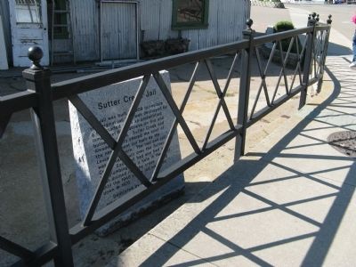
More about this marker. Marker is placed behind an iron fence and can be easily missed. It is also a little difficult to read due to the angle of the marker at the fence.
Credits. This page was last revised on February 10, 2017. It was originally submitted on April 14, 2010, by Syd Whittle of Mesa, Arizona. This page has been viewed 1,289 times since then and 27 times this year. Last updated on July 30, 2012, by Michael Kindig of Elk Grove, California. Photos: 1, 2. submitted on April 14, 2010, by Syd Whittle of Mesa, Arizona. 3. submitted on November 7, 2008, by Syd Whittle of Mesa, Arizona.


