Geneseo in Livingston County, New York — The American Northeast (Mid-Atlantic)
Village Square
Photographed by Yugoboy, July 24, 2012
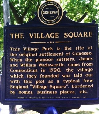
1. Village Square Marker
Erected 1965 by Frederick W. Trotter Post 5005, V.F.W. & Auxiliary.
Topics. This historical marker is listed in this topic list: Settlements & Settlers. A significant historical year for this entry is 1790.
Location. 42° 47.659′ N, 77° 49.042′ W. Marker is in Geneseo, New York, in Livingston County. It is on Main Street (New York State Route 39) 0.2 miles north of South Street (U.S. 20A), on the right when traveling south. Touch for map. Marker is in this post office area: Geneseo NY 14454, United States of America. Touch for directions.

Regionally, this marker is in Upstate New York, specifically in Western New York, in the Finger Lakes, and in the Rochester Metropolitan Area. It is also in the American Northeast and in the Mid-Atlantic. Globally, it is in North America, the Western Hemisphere, the Western World,
this page online
Other nearby markers. At least 8 other markers are within walking distance of this marker: Site of First Church (a few steps from this marker); Geneseo Historic District (a few steps from this marker); Treaty of Big Tree (about 700 feet away, measured in a direct line); Big Tree Lodge (approx. 0.2 miles away); First Bank (approx. 0.2 miles away); History of Mining in the Genesee Valley (approx. 0.2 miles away); Cobblestone School (approx. ¼ mile away); Shaw Sisters (approx. 0.3 miles away). Touch for a list and map of all markers in Geneseo.
Also see . . . Main Street Historic District - National Archives. National Register of Historic Places documentation (Submitted on March 12, 2024, by Anton Schwarzmueller of Wilson, New York.)
Photographed by Yugoboy, July 24, 2012
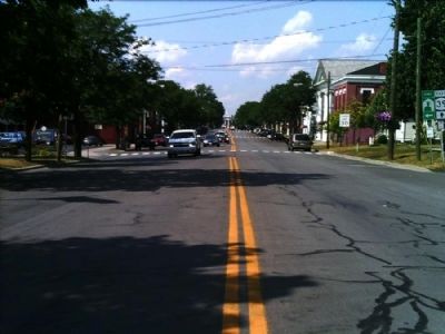
2. Facing North on 39 from approximate location of marker
Photographed by Yugoboy, July 24, 2012
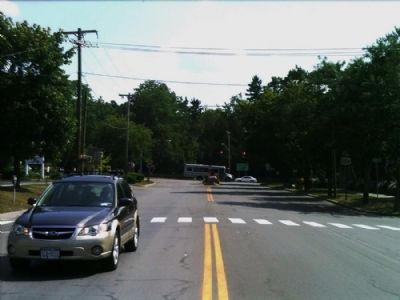
3. Facing South on 39 from approximate location of marker
Credits. This page was last revised on March 12, 2024. It was originally submitted on August 2, 2012, by Yugoboy of Rochester, New York. This page has been viewed 655 times since then and 30 times this year. Photos: 1, 2, 3. submitted on August 2, 2012, by Yugoboy of Rochester, New York. • Bill Pfingsten was the editor who published this page.
